
File:Sumba and Beinisvord in Suduroy, Faroe Islands.JPG

Size of this preview: 800 × 600 pixels. Other resolutions: 320 × 240 pixels | 640 × 480 pixels | 1,024 × 768 pixels | 1,280 × 960 pixels | 2,560 × 1,920 pixels | 3,648 × 2,736 pixels.
Original file (3,648 × 2,736 pixels, file size: 2.06 MB, MIME type: image/jpeg)
| This is a file from the Wikimedia Commons. Information from its description page there is shown below. Commons is a freely licensed media file repository. You can help. |
Summary
| Description |
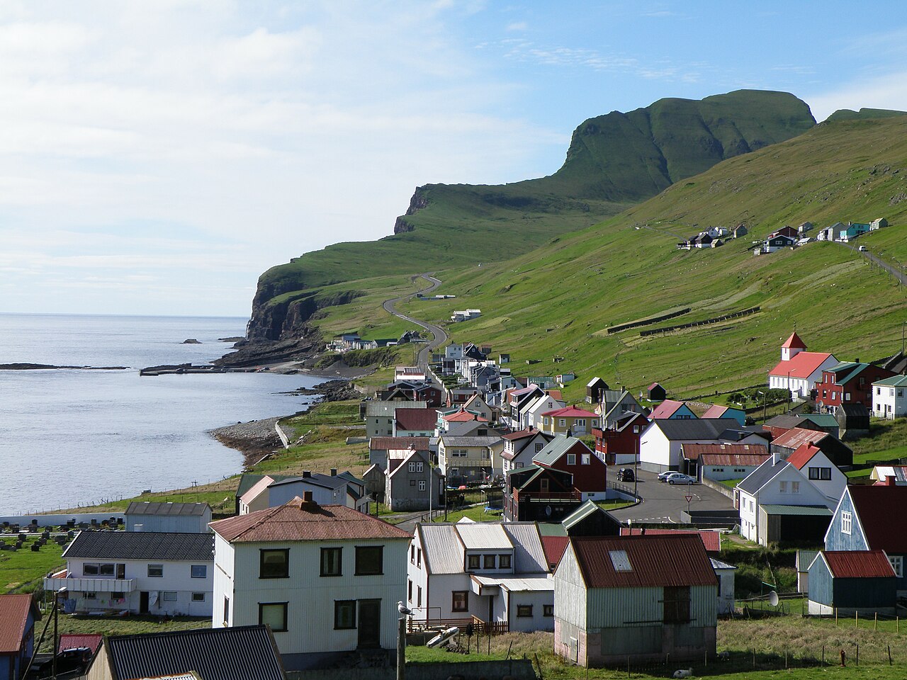
English: Sumba is the southernmost village in the Faroe Islands, located on the south-western coast of the island Suðuroy. Beinisvørð is a 470 meter high sea cliff. It goes vertically down to the North Atlantic Ocean on the western side and on its eastern side it has a green slope, as one can see on this photo. The population of Sumba is around 250. The population of the island Suðuroy is ca. 4900.
Dansk: Sumba er den sydligste bygd på Færøerne. Sumba vender mod sydvest og er karakteriseret af den 470 meter høje klint Beinisvørð, som beskytter bygden mod nordvest. Sumba ligger dog mod åbent hav mod sydvest, kun delvis beskyttet af Sumbiarhólmur. Der bor ca. 250 mennesker i Sumba. Bygden er forbundet med Lopra via en tunnel og med en vej som går over bjergene, forbi Beinisvørð.
Føroyskt: Sumba er bygd í Føroyum. Sumba er syðsta bygd í Suðuroynni. |
| Date | |
| Source | Own work |
| Author | Eileen Sandá |
Licensing
I, the copyright holder of this work, hereby publish it under the following licenses:
This file is licensed under the Creative Commons Attribution-Share Alike 3.0 Unported license.
- You are free:
- to share – to copy, distribute and transmit the work
- to remix – to adapt the work
- Under the following conditions:
- attribution – You must give appropriate credit, provide a link to the license, and indicate if changes were made. You may do so in any reasonable manner, but not in any way that suggests the licensor endorses you or your use.
- share alike – If you remix, transform, or build upon the material, you must distribute your contributions under the same or compatible license as the original.

|
Permission is granted to copy, distribute and/or modify this document under the terms of the GNU Free Documentation License, Version 1.2 or any later version published by the Free Software Foundation; with no Invariant Sections, no Front-Cover Texts, and no Back-Cover Texts. A copy of the license is included in the section entitled GNU Free Documentation License. |
You may select the license of your choice.
File history
Click on a date/time to view the file as it appeared at that time.
| Date/Time | Thumbnail | Dimensions | User | Comment | |
|---|---|---|---|---|---|
| current | 17:23, 18 April 2011 | | 3,648 × 2,736 (2.06 MB) | EileenSanda | {{Information |Description ={{en|1=Sumba is the southernmost village in the Faroe Islands, located on the south-western coast of the island Suðuroy. Beinisvørð is a 470 meter high sea cliff. It goes vertically down to the North Atlantic Ocean on the |
File usage
The following pages on the English Wikipedia use this file (pages on other projects are not listed):
Global file usage
The following other wikis use this file:
- Usage on ca.wikipedia.org
- Usage on da.wikipedia.org
- Usage on el.wikipedia.org
- Usage on es.wikipedia.org
- Usage on eu.wikipedia.org
- Usage on fo.wikipedia.org
- Usage on is.wikipedia.org
- Usage on it.wikipedia.org
- Usage on lt.wikipedia.org
- Usage on nl.wikipedia.org
- Usage on no.wikipedia.org
- Usage on pl.wikipedia.org
- Usage on zh.wikipedia.org