
File:Sumatra 2007 earthquakes map.gif
No higher resolution available.
Sumatra_2007_earthquakes_map.gif (505 × 496 pixels, file size: 30 KB, MIME type: image/gif)
| This is a file from the Wikimedia Commons. Information from its description page there is shown below. Commons is a freely licensed media file repository. You can help. |
Summary
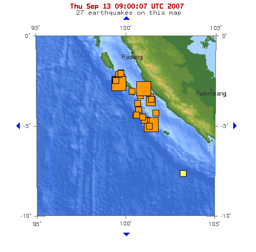
Image: This map shows the location of the 3 major earthquakes and it's many aftershocks off the coast of Sumatra on September 12 and September 13, 2007. It shows a total of 27 earthquakes, 25 of them in the last 24 hours.
Source: https://earthquake.usgs.gov/eqcenter/recenteqsww/Maps/10/100_-5.php (dynamic)
Licensing
This image is in the public domain in the United States because it only contains materials that originally came from the United States Geological Survey, an agency of the United States Department of the Interior. For more information, see the official USGS copyright policy.
|
File history
Click on a date/time to view the file as it appeared at that time.
| Date/Time | Thumbnail | Dimensions | User | Comment | |
|---|---|---|---|---|---|
| current | 09:53, 13 September 2007 | | 505 × 496 (30 KB) | TheDJ | == Summary == '''Image:''' This map shows the location of the 3 major earthquakes and it's many aftershocks off the coast of Sumatra on September 12 and September 13, 2007. It shows a total of 27 earthquakes, 25 of them in the last 24 hours. |
File usage
The following pages on the English Wikipedia use this file (pages on other projects are not listed):
Global file usage
The following other wikis use this file:
- Usage on de.wikipedia.org
- Usage on id.wikipedia.org
- Usage on ja.wikipedia.org
- Usage on wuu.wikipedia.org
- Usage on zh.wikipedia.org