
File:Sulawesi location map plain.svg

Size of this PNG preview of this SVG file: 475 × 599 pixels. Other resolutions: 190 × 240 pixels | 381 × 480 pixels | 609 × 768 pixels | 812 × 1,024 pixels | 1,624 × 2,048 pixels | 744 × 938 pixels.
Original file (SVG file, nominally 744 × 938 pixels, file size: 1,012 KB)
| This is a file from the Wikimedia Commons. Information from its description page there is shown below. Commons is a freely licensed media file repository. You can help. |
Summary
| Description |
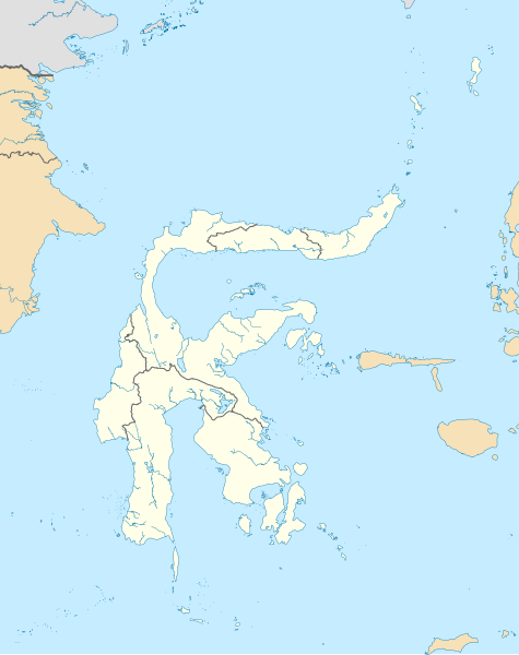
Bahasa Indonesia: Peta Pulau Sulawesi dengan batas administratif serta pulau-pulau di sekitarnya yang termasuk dalam provinsi yang ada di Sulawesi. Cakupan peta dibuat lebih besar untuk menampilkan Liukang Tangaya dan Masalima, Sulawesi Selatan, Bala Balakang, Sulawesi Barat, serta Miangas, Sulawesi Utara. Saya tidak menyertakan batas perairan karena tidak ada sumber resmi yang saya dapat temukan.
English: Plain map of the island of Sulawesi with administrative borders and surrounding islands belonged to the provinces in the island, including Liukang Tangaya and Masalima, South Sulawesi, Bala Balakang, West Sulawesi, and Miangas, North Sulawesi. I did not add maritime borders because I did not find any official sources in regards to it. |
|||||||||
| Creation | This W3C-unspecified vector image was created with Inkscape . This W3C-unspecified vector image was created with QGIS. |
|||||||||
| Date | ||||||||||
| Source |
Bahasa Indonesia: Karya sendiri;
English: Own work;
|
|||||||||
| Creator | ||||||||||
| Permission (Reusing this file) |
Attribution like in #Licensing below is required for including this image outside of Wikimedia projects. | |||||||||
| Geotemporal data | ||||||||||
| Spatial reference system | Equirectangular | |||||||||
| Heading |
 |
|||||||||
| Bounding box |
|
|||||||||
| Other versions |
|
|||||||||

Licensing
I, the copyright holder of this work, hereby publish it under the following license:
This file is licensed under the Creative Commons Attribution-Share Alike 4.0 International license.
Attribution: RXerself/Wikimedia Commons/CC BY-SA 4.0
- You are free:
- to share – to copy, distribute and transmit the work
- to remix – to adapt the work
- Under the following conditions:
- attribution – You must give appropriate credit, provide a link to the license, and indicate if changes were made. You may do so in any reasonable manner, but not in any way that suggests the licensor endorses you or your use.
- share alike – If you remix, transform, or build upon the material, you must distribute your contributions under the same or compatible license as the original.
File history
Click on a date/time to view the file as it appeared at that time.
| Date/Time | Thumbnail | Dimensions | User | Comment | |
|---|---|---|---|---|---|
| current | 12:50, 27 October 2020 | | 744 × 938 (1,012 KB) | RXerself | Sonit |
| 05:43, 24 October 2020 |  | 744 × 938 (1,012 KB) | RXerself | Bala Balakang | |
| 23:10, 23 October 2020 |  | 744 × 938 (1,012 KB) | RXerself | {{Map |Description={{id|1=Peta Pulau Sulawesi dengan batas administratif serta pulau-pulau di sekitarnya yang termasuk dalam provinsi yang ada di Sulawesi. Cakupan peta dibuat lebih besar untuk menampilkan Liukang Tangaya dan Masalima, Sulawesi Selatan serta Miangas, Sulawesi Utara.}} {{en|1=Plain map of the island of Sulawesi with administrative borders and surrounding islands belonged to the provinces in the island, including Liukang Tangaya and Masalima, S... |
File usage
More than 100 pages use this file. The following list shows the first 100 pages that use this file only. A full list is available.
- Adam Air Flight 574
- Ambang Stadium
- Andi Mattalatta Stadium
- Atinggola
- Banggai Islands Regency
- Banggai Regency
- Bantimurung–Bulusaraung National Park
- Baubau
- Bitung
- Boalemo Regency
- Bogani Nani Wartabone National Park
- Bolaang Mongondow Regency
- Bombana Regency
- Bontobahari
- Bunaken National Park
- Buol (town)
- Buol Regency
- Buton
- Buton Regency
- Chloritis minahassae
- Donggala Regency
- East Peninsula, Sulawesi
- Gorontalo (city)
- Gowa Regency
- Gulf of Boni
- Gulf of Tomini
- Haluoleo Airport
- Jalaluddin Airport
- Kabaena
- Karakelong
- Kasiguncu Airport
- Kendari
- Kepulauan Togean National Park
- Kolaka Regency
- Konawe Regency
- Lagaligo Stadium
- Lariang River
- Larompong
- List of national parks of Indonesia
- Luwuk
- Maesa Stadium
- Majene
- Makassar
- Malino, Indonesia
- Mamuju (city)
- Manado
- Masamba
- Matahora Airport
- Merdeka Stadium (Gorontalo)
- Minahasa Peninsula
- Morowali Regency
- Muna Island
- Muna Regency
- Mutiara SIS Al-Jufrie Airport
- Naha Airport (Indonesia)
- Ngapa, Central Sulawesi
- Ngapa, Southeast Sulawesi
- North Buton Regency
- North Kolaka Regency
- North Konawe Regency
- Palopo
- Palu
- Pangkajene and Islands Regency
- Parepare
- Parigi Moutong Regency
- Pasangkayu Regency
- Peleng
- Pitumpanua
- Pogogul Airport
- Pongtiku Airport
- Poso
- Poso Regency
- Rawa Aopa Watumohai National Park
- Sam Ratulangi International Airport
- Sangihe Islands Regency
- Sangir Island
- Seko, Indonesia
- Selayar Island
- Selayar Islands Regency
- Siau Tagulandang Biaro Islands Regency
- Sidenreng Rappang Regency
- Sigi Regency
- Sinjai Regency
- Soroako Airport
- South Konawe Regency
- South Peninsula, Sulawesi
- Southeast Peninsula, Sulawesi
- Sultan Bantilan Airport
- Sultan Hasanuddin International Airport
- Taka Bonerate National Park
- Talaud Islands Regency
- Tangkoko Batuangus Nature Reserve
- Tojo Una-Una Regency
- Tolitoli Regency
- Tomohon
- Ujunglero
- Wakatobi National Park
- Wakatobi Regency
- Watansoppeng
- Wawonii Island
View more links to this file.
Global file usage
The following other wikis use this file:
- Usage on id.wikipedia.org
- Kabupaten Bolaang Mongondow
- Kabupaten Bantaeng
- Kabupaten Bone
- Kabupaten Bulukumba
- Kabupaten Enrekang
- Kabupaten Gowa
- Kabupaten Jeneponto
- Kabupaten Luwu
- Kabupaten Majene
- Kabupaten Mamuju
- Kabupaten Maros
- Kabupaten Pangkajene dan Kepulauan
- Kota Parepare
- Kabupaten Pinrang
- Kabupaten Kepulauan Selayar
- Kabupaten Sidenreng Rappang
- Kabupaten Sinjai
- Kabupaten Soppeng
- Kabupaten Takalar
- Kabupaten Tana Toraja
- Kota Makassar
- Kabupaten Wajo
- Kabupaten Buton
- Kota Kendari
- Kabupaten Kolaka
- Kabupaten Muna
- Kabupaten Banggai
- Kabupaten Donggala
- Kota Palu
- Kabupaten Poso
- Kota Manado
- Kabupaten Minahasa
- Kota Tomohon
- Kabupaten Mamasa
- Kota Kotamobagu
- Kota Bitung
- Kabupaten Minahasa Selatan
- Kabupaten Kepulauan Talaud
- Kota Baubau
- Kabupaten Gorontalo
- Pulau Lae-Lae
- Kabupaten Minahasa Utara
- Bandar Udara Kasiguncu
- Kabupaten Boalemo
- Kabupaten Bone Bolango
- Kabupaten Pohuwato
- Kabupaten Konawe
- Kabupaten Kepulauan Sangihe
- Kabupaten Polewali Mandar
- Kabupaten Pasangkayu
View more global usage of this file.