
File:Sugarloaf Pkwy Phase II.jpg
Size of this preview: 800 × 509 pixels. Other resolutions: 320 × 203 pixels | 640 × 407 pixels | 1,024 × 651 pixels | 1,280 × 814 pixels | 1,700 × 1,081 pixels.
Original file (1,700 × 1,081 pixels, file size: 194 KB, MIME type: image/jpeg)
| This is a file from the Wikimedia Commons. Information from its description page there is shown below. Commons is a freely licensed media file repository. You can help. |
Summary
| Description |
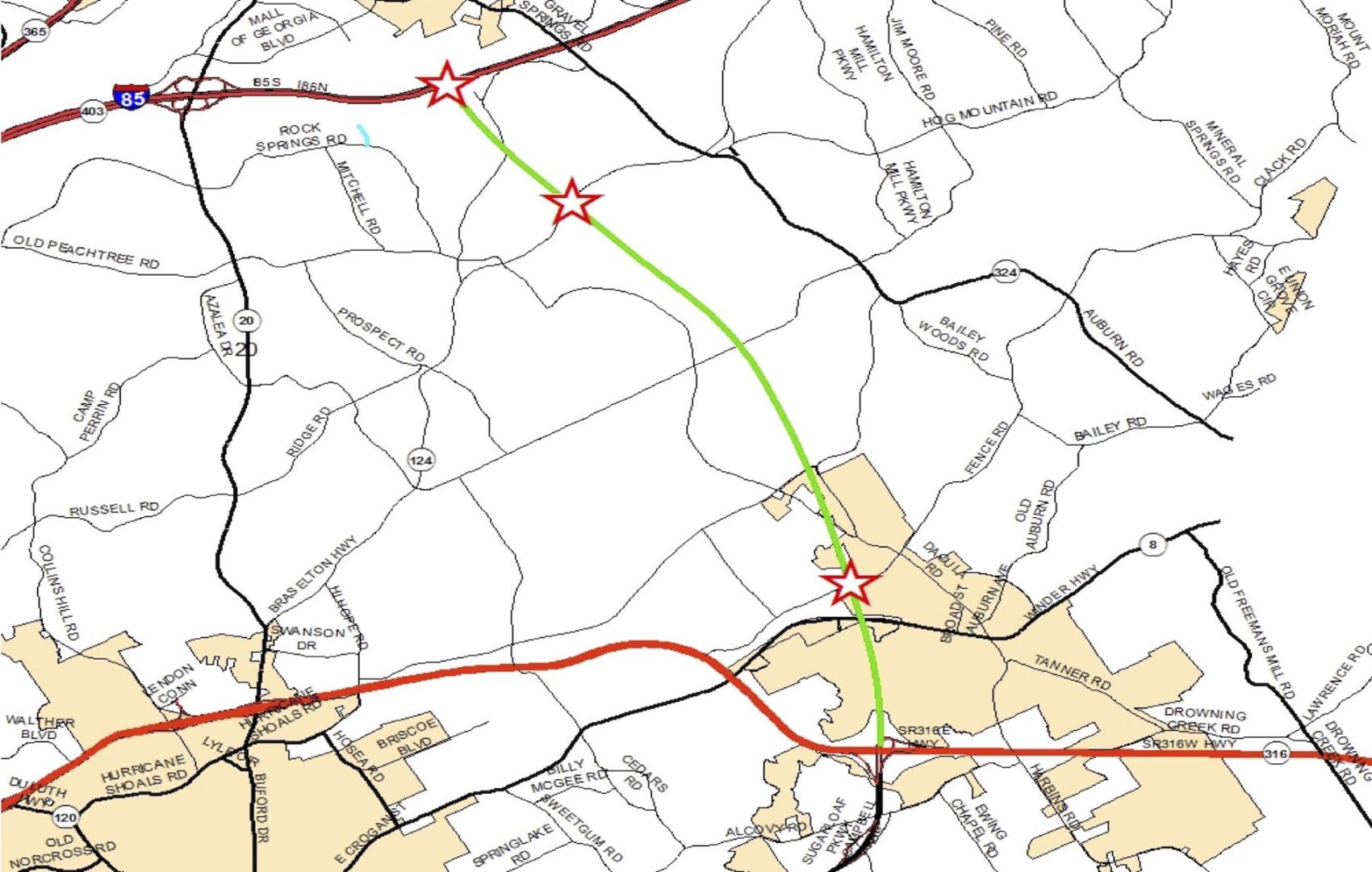
English: This map shows the anticipated route that the Sugarloaf Parkway extension Phase II project will take. The middle star on the highlighted route shows where an interchange at Braselton Highway is expected to be located. County commissioners agreed to pay a combined amount of nearly $1.5 million to the owners of two pieces of property that are located where the interchange will be built. (Photo: Gwinnett County) |
| Date | |
| Source | Own work |
| Author | Jwfergie |
Licensing
I, the copyright holder of this work, hereby publish it under the following license:
This file is licensed under the Creative Commons Attribution-Share Alike 4.0 International license.
- You are free:
- to share – to copy, distribute and transmit the work
- to remix – to adapt the work
- Under the following conditions:
- attribution – You must give appropriate credit, provide a link to the license, and indicate if changes were made. You may do so in any reasonable manner, but not in any way that suggests the licensor endorses you or your use.
- share alike – If you remix, transform, or build upon the material, you must distribute your contributions under the same or compatible license as the original.
File history
Click on a date/time to view the file as it appeared at that time.
| Date/Time | Thumbnail | Dimensions | User | Comment | |
|---|---|---|---|---|---|
| current | 14:07, 30 May 2019 | | 1,700 × 1,081 (194 KB) | Jwfergie | Cross-wiki upload from en.wikipedia.org |
File usage
The following pages on the English Wikipedia use this file (pages on other projects are not listed):