
File:Stop Digging ^ - geograph.org.uk - 195319.jpg
No higher resolution available.
Stop_Digging_^_-_geograph.org.uk_-_195319.jpg (561 × 429 pixels, file size: 75 KB, MIME type: image/jpeg)
| This is a file from the Wikimedia Commons. Information from its description page there is shown below. Commons is a freely licensed media file repository. You can help. |
Summary
| Description |
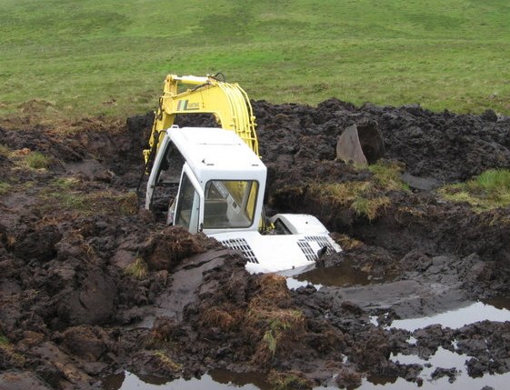
English: An excavator half-submerged in a large hole that it dug before falling in. A peat bog near Locherben, Dumfries and Galloway, Scotland. |
||||
| Date | |||||
| Source | geograph.org.uk | ||||
| Author | Chris Wimbush | ||||
| Permission (Reusing this file) |
This file is licensed under the Creative Commons Attribution-Share Alike 2.0 Generic license. Attribution: Chris Wimbush
|
||||
| Attribution (required by the license) | Chris Wimbush / Stop Digging ? / | ||||

| Camera location | | View this and other nearby images on: OpenStreetMap |
|---|
_heading:90.00&language=en)
| Object location | | View this and other nearby images on: OpenStreetMap |
|---|
_heading:90.00&language=en)
File history
Click on a date/time to view the file as it appeared at that time.
| Date/Time | Thumbnail | Dimensions | User | Comment | |
|---|---|---|---|---|---|
| current | 21:10, 14 December 2016 | | 561 × 429 (75 KB) | EEng | crop |
| 18:49, 31 January 2010 |  | 640 × 480 (98 KB) | GeographBot | == {{int:filedesc}} == {{Information |description={{en|1=Stop Digging ? A possible permanent landmark unless it sinks out of sight into the peat}} |date=2006-07-01 |source=From [http://www.geograph.org.uk/photo/195319 geograph.org.uk] |author=[http://www. |
File usage
The following pages on the English Wikipedia use this file (pages on other projects are not listed):
Global file usage
The following other wikis use this file:
- Usage on fa.wikipedia.org
- Usage on fr.wikipedia.org
- Usage on www.wikidata.org
- Usage on yo.wikipedia.org