
File:Stanley park map.jpg
No higher resolution available.
Stanley_park_map.jpg (299 × 188 pixels, file size: 17 KB, MIME type: image/jpeg)
| This is a file from the Wikimedia Commons. Information from its description page there is shown below. Commons is a freely licensed media file repository. You can help. |
Summary
| Description |
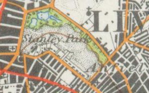
English: Stanley Park map in 1945. |
| Source | Own work |
| Author | user:DennisPeeters |
| Permission (Reusing this file) |
This work is in the public domain because it is an Ordnance Survey map over 50 years old. Ordnance Survey maps are covered by crown copyright which in this case expires 50 years after publication. Ordnance Survey does however |
Licensing
| This file is licensed under the Creative Commons Attribution-Share Alike 3.0 Unported license. Subject to disclaimers. | ||
| ||
| This licensing tag was added to this file as part of the GFDL licensing update. |

|
Permission is granted to copy, distribute and/or modify this document under the terms of the GNU Free Documentation License, Version 1.2 or any later version published by the Free Software Foundation; with no Invariant Sections, no Front-Cover Texts, and no Back-Cover Texts. A copy of the license is included in the section entitled GNU Free Documentation License. Subject to disclaimers. |
File history
Click on a date/time to view the file as it appeared at that time.
| Date/Time | Thumbnail | Dimensions | User | Comment | |
|---|---|---|---|---|---|
| current | 07:43, 5 June 2007 | | 299 × 188 (17 KB) | DennisPeeters | (Stanley Park map in 1945. ''This work is in the public domain because it is an Ordnance Survey map over 50 years old. Ordnance Survey maps are covered by crown copyright which in this case expires 50 years after publication. Ordnance Survey does however) |
File usage
The following pages on the English Wikipedia use this file (pages on other projects are not listed):
Global file usage
The following other wikis use this file:
- Usage on nl.wikipedia.org
- Usage on sv.wikipedia.org