
File:St James Old Ordnance Survey Map 1899.jpg
Size of this preview: 399 × 599 pixels. Other resolutions: 160 × 240 pixels | 320 × 480 pixels | 850 × 1,276 pixels.
Original file (850 × 1,276 pixels, file size: 725 KB, MIME type: image/jpeg)
Summary[edit]
{{Information |Description =
| Description |
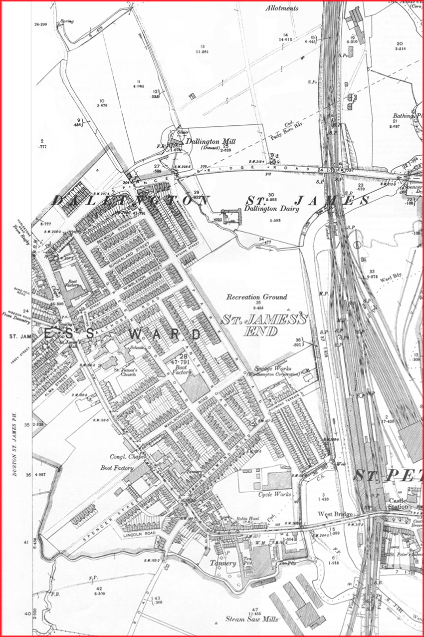
English: Extract of Old Ordnance Survey Map for Northampton showing the St James part of the town | ||||||||||
|---|---|---|---|---|---|---|---|---|---|---|---|
| Source |
Original publication: Dated 1899, revised 1901 | ||||||||||
| Date |
1899 | ||||||||||
| Author |
Ordnance Survey | ||||||||||
| Permission (Reusing this file) |
|
Licensing[edit]
| This work is in the public domain in the United States because it was published (or registered with the U.S. Copyright Office) before January 1, 1929. |
File history
Click on a date/time to view the file as it appeared at that time.
| Date/Time | Thumbnail | Dimensions | User | Comment | |
|---|---|---|---|---|---|
| current | 16:26, 15 January 2014 | | 850 × 1,276 (725 KB) | Cj1340 (talk | contribs) | Uploading an old public-domain work using File Upload Wizard |
You cannot overwrite this file.
File usage
The following pages on the English Wikipedia use this file (pages on other projects are not listed):