
File:St.-Jacob-Church.jpg
Size of this preview: 491 × 599 pixels. Other resolutions: 196 × 240 pixels | 393 × 480 pixels | 629 × 768 pixels | 839 × 1,024 pixels | 1,677 × 2,048 pixels | 2,689 × 3,283 pixels.
Original file (2,689 × 3,283 pixels, file size: 5.2 MB, MIME type: image/jpeg)
| This is a file from the Wikimedia Commons. Information from its description page there is shown below. Commons is a freely licensed media file repository. You can help. |
| Description |
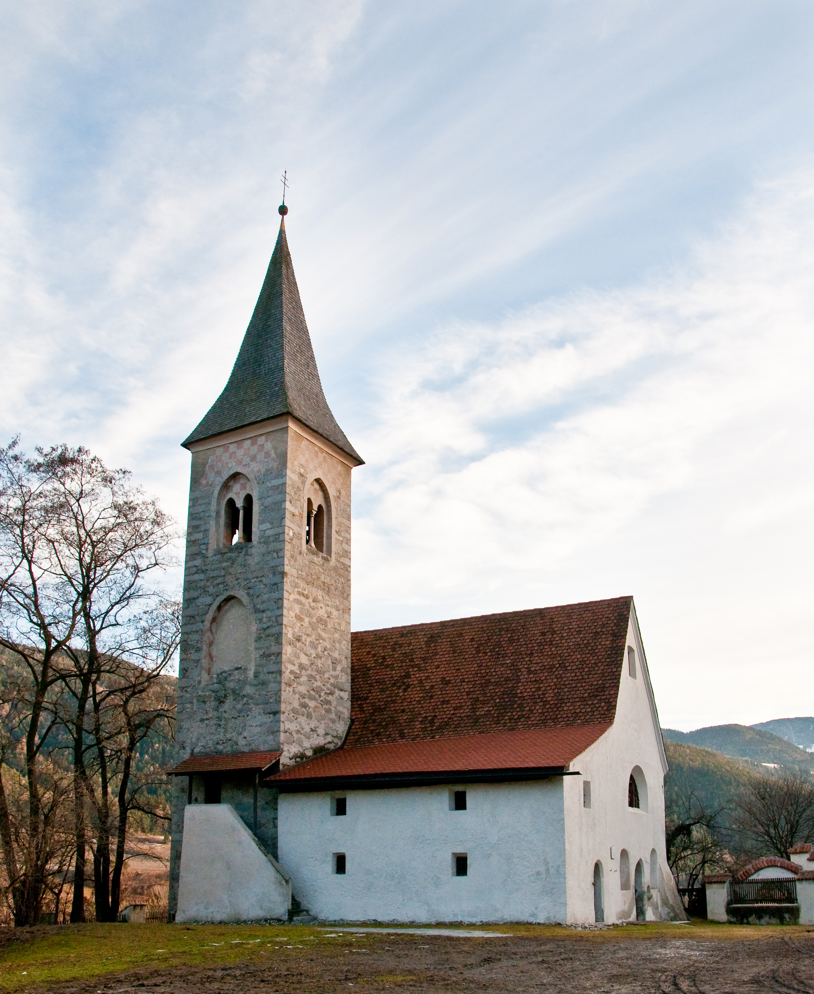
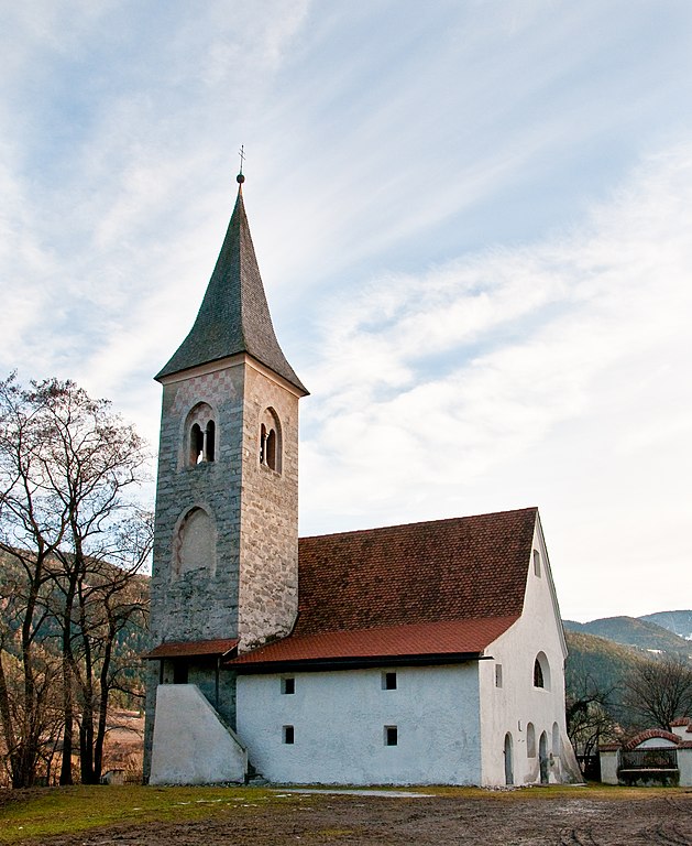
St. Jakob in der Mahr: the small church was mentioned for the first time in 1173. It was consecrated in 1428 to the patron of the pilgrims. On the inside, the artistic decor is remarkable: in the vault the lamb God, surrounded by 16 arms, such as Brixen, Kärnten, Austria and many local aristocratic families. The representation of the legend of Jakob in the choir is from the painter- school of Master Leonhard von Brixen.
|
||
| Date | |||
| Source | originally posted to Flickr as St.-Jacob-Church | ||
| Author | Michele Bighignoli | ||
| Permission (Reusing this file) |
This file is licensed under the Creative Commons Attribution-Share Alike 2.0 Generic license.
|
| Object location | | View this and other nearby images on: OpenStreetMap |
|---|
File history
Click on a date/time to view the file as it appeared at that time.
| Date/Time | Thumbnail | Dimensions | User | Comment | |
|---|---|---|---|---|---|
| current | 07:59, 5 March 2010 | | 2,689 × 3,283 (5.2 MB) | Flickr upload bot | Uploaded from http://flickr.com/photo/29937169@N02/4405015644 using Flickr upload bot |
File usage
The following pages on the English Wikipedia use this file (pages on other projects are not listed):
Global file usage
The following other wikis use this file:
- Usage on de.wikipedia.org
- Usage on et.wikipedia.org
- Usage on it.wikipedia.org
- Usage on tl.wikipedia.org
- Usage on www.wikidata.org