
File:South Waikato Territorial Authority.PNG
No higher resolution available.
South_Waikato_Territorial_Authority.PNG (246 × 352 pixels, file size: 7 KB, MIME type: image/png)
| This is a file from the Wikimedia Commons. Information from its description page there is shown below. Commons is a freely licensed media file repository. You can help. |
Summary
| Description |
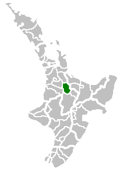
English: Map for South Waikato Territorial Authority |
| Date | 8 December 2006 (original upload date) |
| Source | Transferred from en.wikipedia to Commons. |
| Author | Tom the Boffin at English Wikipedia |
Licensing
| This work has been released into the public domain by its author, Tom the Boffin at English Wikipedia. This applies worldwide. In some countries this may not be legally possible; if so: Tom the Boffin grants anyone the right to use this work for any purpose, without any conditions, unless such conditions are required by law. |
Original upload log
The original description page was here. All following user names refer to en.wikipedia.
- 2006-12-08 01:51 Tom the Boffin 246×352×??? (6666 bytes) Map for South Waikato Territorial Authority
File history
Click on a date/time to view the file as it appeared at that time.
| Date/Time | Thumbnail | Dimensions | User | Comment | |
|---|---|---|---|---|---|
| current | 13:00, 25 August 2008 | | 246 × 352 (7 KB) | Arria Belli | {{Information |Description={{en|Map for South Waikato Territorial Authority}} |Source=Transferred from [http://en.wikipedia.org en.wikipedia] |Date=2006-12-08 (original upload date) |Author=Original uploader was Tom the Boffin |
File usage
No pages on the English Wikipedia use this file (pages on other projects are not listed).
Global file usage
The following other wikis use this file:
- Usage on ca.wikipedia.org
- Usage on fr.wikipedia.org
- Usage on it.wikipedia.org
- Usage on ms.wikipedia.org
- Usage on pnb.wikipedia.org
- Usage on www.wikidata.org