
File:Somaliland map regions.png
Size of this preview: 800 × 498 pixels. Other resolutions: 320 × 199 pixels | 640 × 398 pixels | 1,006 × 626 pixels.
Original file (1,006 × 626 pixels, file size: 61 KB, MIME type: image/png)
| This is a file from the Wikimedia Commons. Information from its description page there is shown below. Commons is a freely licensed media file repository. You can help. |
Summary
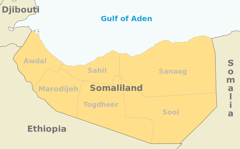
| Description | Map of the Republic of Somaliland |
| Date | |
| Source | Own work |
| Author | Ingoman |
| Other versions | Derivative works of this file: Somaliland map regions He.jpg |
Licensing
| I, the copyright holder of this work, release this work into the public domain. This applies worldwide. In some countries this may not be legally possible; if so: I grant anyone the right to use this work for any purpose, without any conditions, unless such conditions are required by law. |
File history
Click on a date/time to view the file as it appeared at that time.
| Date/Time | Thumbnail | Dimensions | User | Comment | |
|---|---|---|---|---|---|
| current | 00:04, 10 June 2021 | | 1,006 × 626 (61 KB) | Siirski | Update |
| 19:05, 27 February 2008 |  | 1,048 × 705 (50 KB) | Ingoman | ||
| 17:23, 14 December 2007 |  | 1,132 × 744 (49 KB) | Ingoman | ||
| 21:39, 27 October 2007 |  | 1,236 × 796 (69 KB) | Ingoman | ||
| 02:00, 25 October 2007 |  | 1,456 × 808 (75 KB) | Ingoman | ||
| 07:41, 22 October 2007 |  | 1,592 × 904 (80 KB) | Ingoman | ||
| 03:17, 2 October 2007 |  | 1,264 × 913 (51 KB) | Ingoman | {{Information |Description=Map of the Republic of Somaliland |Source=self-made |Date=October 1st 2007 |Author= Ingoman }} |
File usage
The following pages on the English Wikipedia use this file (pages on other projects are not listed):
Global file usage
The following other wikis use this file:
- Usage on azb.wikipedia.org
- Usage on bg.wikipedia.org
- Usage on cy.wikipedia.org
- Usage on he.wikipedia.org
- Usage on pl.wikipedia.org
- Usage on pt.wikipedia.org
- Usage on uk.wikipedia.org
- Usage on zh.wikipedia.org