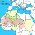
File:Somali Civil War (2009-present).svg

Size of this PNG preview of this SVG file: 472 × 599 pixels. Other resolutions: 189 × 240 pixels | 378 × 480 pixels | 605 × 768 pixels | 806 × 1,024 pixels | 1,613 × 2,048 pixels | 512 × 650 pixels.
Original file (SVG file, nominally 512 × 650 pixels, file size: 506 KB)
File history
Click on a date/time to view the file as it appeared at that time.
| Date/Time | Thumbnail | Dimensions | User | Comment | |
|---|---|---|---|---|---|
| current | 02:53, 7 April 2024 |  | 512 × 650 (506 KB) | Rnmeow | Reverted to version as of 08:51, 28 February 2024 (UTC) |
| 08:41, 2 March 2024 |  | 634 × 805 (210 KB) | Sloanand18 | Reverted to version as of 01:34, 13 January 2024 (UTC) | |
| 08:51, 28 February 2024 |  | 512 × 650 (506 KB) | Hawkers994 | Reverted to version as of 06:46, 12 August 2020 (UTC) incorrect map there us no gabiley under berbera | |
| 04:01, 11 February 2024 |  | 634 × 805 (210 KB) | Socialwave597 | Reverted to version as of 17:53, 19 January 2024 (UTC) this map is old | |
| 06:26, 10 February 2024 |  | 512 × 650 (506 KB) | Subayerboombastic | Reverted to version as of 20:27, 18 January 2024 (UTC) Sources needed for Sanaag portion of this map. What evidence is there that Somaliland was pushed back in Sannag? | |
| 17:53, 19 January 2024 |  | 634 × 805 (210 KB) | Sifeeye | See talk section for my sources, it's absurd that Hawkers994 is clinging to a four year old version and refusing to consider any new sources. | |
| 20:27, 18 January 2024 |  | 512 × 650 (506 KB) | Hawkers994 | Reverted to version as of 06:46, 12 August 2020 (UTC)last reliable file used | |
| 17:27, 18 January 2024 |  | 634 × 805 (210 KB) | Sifeeye | Reverted to version as of 01:34, 13 January 2024 (UTC) No sources from Hawkers994 | |
| 13:39, 18 January 2024 |  | 512 × 650 (507 KB) | Hawkers994 | Reverted to version as of 10:10, 3 April 2020 (UTC) | |
| 01:34, 13 January 2024 |  | 634 × 805 (210 KB) | Sifeeye | I've updated the current development in the disputed territory since it hasn't been revised since 2020, i've linked my sources in the talk section https://commons.wikimedia.org/wiki/File_talk:Somali_Civil_War_(2009-present).svg#Updating_northern_region. |
File usage
The following pages on the English Wikipedia use this file (pages on other projects are not listed):
- Freedom of religion in Africa by country
- Freedom of religion in Somalia
- Greater Somalia
- History of al-Qaeda
- LGBT rights in Somalia
- Somalia
- Sool
- User:Borysk5
- User:Edisonabcd/sandbox
- User:Kopiersperre
- User:Oganesson007/Civil war maps
- User:StrombusJigs/sandbox
- User talk:Banak
- User talk:Spesh531/Archive 2016
Global file usage
The following other wikis use this file:
- Usage on ar.wikipedia.org
- Usage on azb.wikipedia.org
- Usage on bn.wikipedia.org
- Usage on ca.wikipedia.org
- Usage on cs.wikipedia.org
- Usage on de.wikipedia.org
- Usage on el.wikipedia.org
- Usage on es.wikipedia.org
- Usage on fa.wikipedia.org
- Usage on fr.wikipedia.org
- Usage on he.wikipedia.org
- Usage on hu.wikipedia.org
- Usage on id.wikipedia.org
- Usage on it.wikipedia.org
- Usage on ja.wikipedia.org
- Usage on ka.wikipedia.org
- Usage on ko.wikipedia.org
- Usage on lv.wikipedia.org
- Usage on pl.wikipedia.org
- Usage on pt.wikipedia.org
- Usage on ro.wikipedia.org
- Usage on ru.wikipedia.org
- Usage on simple.wikipedia.org
- Usage on th.wikipedia.org
- Usage on tr.wikipedia.org
- Usage on tum.wikipedia.org
- Usage on uk.wikipedia.org
- Usage on ur.wikipedia.org
- Usage on vi.wikipedia.org
- Usage on www.wikidata.org
View more global usage of this file.


