
File:Solitario shaded relief - plain.jpg

Size of this preview: 800 × 590 pixels. Other resolutions: 320 × 236 pixels | 640 × 472 pixels | 1,024 × 756 pixels | 1,232 × 909 pixels.
Original file (1,232 × 909 pixels, file size: 877 KB, MIME type: image/jpeg)
| This is a file from the Wikimedia Commons. Information from its description page there is shown below. Commons is a freely licensed media file repository. You can help. |
Summary
| Description |
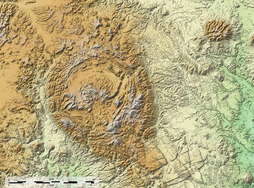
English: Shaded relief map of The Solitario in southwest Texas. Vertical elevation ranges from 826 to 1606 meters above sea level. This map uses the map projection described by EPSG id 26913: It is a UTM projection in Zone 13N using the GRS 80 ellipsoid and the WGS 84 datum. This map at the original size (1,232 × 909 pixels) can be georeferenced with this world file:
|
| Date | |
| Source | Own work |
| Author | Kbh3rd |
Licensing
I, the copyright holder of this work, hereby publish it under the following licenses:
This file is licensed under the Creative Commons Attribution-Share Alike 3.0 Unported license.
- You are free:
- to share – to copy, distribute and transmit the work
- to remix – to adapt the work
- Under the following conditions:
- attribution – You must give appropriate credit, provide a link to the license, and indicate if changes were made. You may do so in any reasonable manner, but not in any way that suggests the licensor endorses you or your use.
- share alike – If you remix, transform, or build upon the material, you must distribute your contributions under the same or compatible license as the original.

|
Permission is granted to copy, distribute and/or modify this document under the terms of the GNU Free Documentation License, Version 1.2 or any later version published by the Free Software Foundation; with no Invariant Sections, no Front-Cover Texts, and no Back-Cover Texts. A copy of the license is included in the section entitled GNU Free Documentation License. |
You may select the license of your choice.
File history
Click on a date/time to view the file as it appeared at that time.
| Date/Time | Thumbnail | Dimensions | User | Comment | |
|---|---|---|---|---|---|
| current | 05:09, 20 June 2010 | | 1,232 × 909 (877 KB) | Kbh3rd | {{Information |Description={{en|1=Shaded relief map of The Solitario in southwest Texas. Vertical elevation ranges from 826 to 1606 meters above sea level.}} |Source={{own}} |Author=Kbh3rd |Date=2010-06-20 |
File usage
The following pages on the English Wikipedia use this file (pages on other projects are not listed):
Global file usage
The following other wikis use this file:
- Usage on arz.wikipedia.org
- Usage on ceb.wikipedia.org
- Usage on lld.wikipedia.org
- Usage on www.wikidata.org