
File:Snohomish County, Wash.svg

Size of this PNG preview of this SVG file: 800 × 448 pixels. Other resolutions: 320 × 179 pixels | 640 × 358 pixels | 1,024 × 573 pixels | 1,280 × 716 pixels | 2,560 × 1,432 pixels | 1,169 × 654 pixels.
Original file (SVG file, nominally 1,169 × 654 pixels, file size: 589 KB)
| This is a file from the Wikimedia Commons. Information from its description page there is shown below. Commons is a freely licensed media file repository. You can help. |
Summary
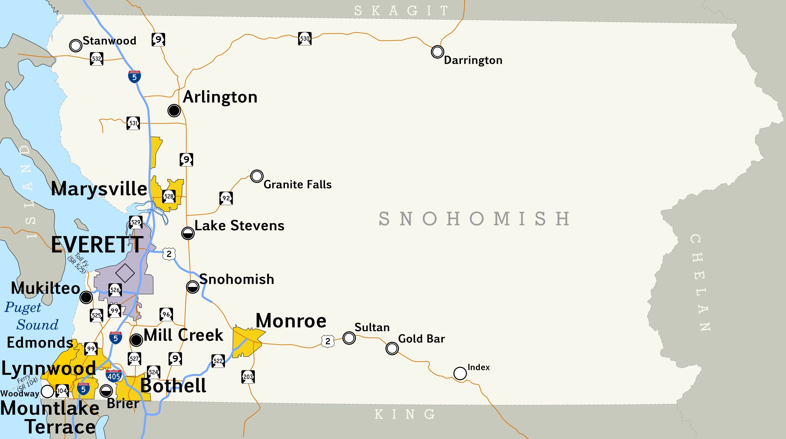
| Description | Map of Snohomish County, Washington. |
| Date | |
| Source | Created by me. Based on data collected from [1] and [2], which was loaded into Quantum GIS 0.11.0 and used to export a PNG. This was then loaded into Inkscape, the county outline and roads were traced, and the other map symbols placed by hand. Most text is set in Pigiarniq, a font produced by the government of the Canadian province of Nunavut. |
| Author | Scott Nazelrod |
| Permission (Reusing this file) |
CC-BY-SA |
| SVG development |
Licensing
This file is licensed under the Creative Commons Attribution-Share Alike 3.0 Unported license.
- You are free:
- to share – to copy, distribute and transmit the work
- to remix – to adapt the work
- Under the following conditions:
- attribution – You must give appropriate credit, provide a link to the license, and indicate if changes were made. You may do so in any reasonable manner, but not in any way that suggests the licensor endorses you or your use.
- share alike – If you remix, transform, or build upon the material, you must distribute your contributions under the same or compatible license as the original.
File history
Click on a date/time to view the file as it appeared at that time.
| Date/Time | Thumbnail | Dimensions | User | Comment | |
|---|---|---|---|---|---|
| current | 18:05, 29 October 2008 | | 1,169 × 654 (589 KB) | Scott5114 | corrections |
| 18:03, 28 October 2008 |  | 1,169 × 654 (591 KB) | Scott5114 | Reposition some elements so as to not get cut off by the edge of the canvas | |
| 05:20, 28 October 2008 |  | 1,169 × 654 (591 KB) | Scott5114 | {{Information |Description=Map of Snohomish County, Washington. |Source=Created by me. Based on data collected from [http://www.census.gov/cgi-bin/geo/shapefiles/state-files?state=53] and [http://www.fhwa.dot.gov/planning/nhpn/], which was loaded into Qua |
File usage
The following pages on the English Wikipedia use this file (pages on other projects are not listed):
Global file usage
The following other wikis use this file:
- Usage on de.wikipedia.org
- Usage on id.wikipedia.org