
File:Slovak-Ukrainian state border between Čierna nad Tisou and Solomonovo (from UA side) 02.jpg

Size of this preview: 800 × 451 pixels. Other resolutions: 320 × 180 pixels | 640 × 361 pixels | 1,024 × 577 pixels | 1,280 × 722 pixels | 3,264 × 1,840 pixels.
Original file (3,264 × 1,840 pixels, file size: 2.09 MB, MIME type: image/jpeg)
| This is a file from the Wikimedia Commons. Information from its description page there is shown below. Commons is a freely licensed media file repository. You can help. |
_02.jpg)
Summary
| Description |
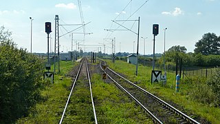
English: Slovak-Ukrainian state border between Čierna nad Tisou and Solomonovo (from UA side)
Slovenčina: Slovensko-ukrajinská hranica medzi Čiernou nad Tisou a Šalamúnovou z ukrajinskej strany
Русский: Словацко-украинская граница между Чьерна-над-Тисой и Соломоново, вид с украинской стороны |
| Date | |
| Source | https://railwayz.info/photolines/author/143 |
| Author | Михаил Кульгейко |
| Permission (Reusing this file) |
| Camera location | | View this and other nearby images on: OpenStreetMap |
|---|
_02.jpg¶ms=048.432666_N_0022.137740_E_globe:Earth_type:camera__&language=en)
Licensing
This file is licensed under the Creative Commons Attribution-Share Alike 4.0 International license.
- You are free:
- to share – to copy, distribute and transmit the work
- to remix – to adapt the work
- Under the following conditions:
- attribution – You must give appropriate credit, provide a link to the license, and indicate if changes were made. You may do so in any reasonable manner, but not in any way that suggests the licensor endorses you or your use.
- share alike – If you remix, transform, or build upon the material, you must distribute your contributions under the same or compatible license as the original.
| Annotations | This image is annotated: View the annotations at Commons |
File history
Click on a date/time to view the file as it appeared at that time.
| Date/Time | Thumbnail | Dimensions | User | Comment | |
|---|---|---|---|---|---|
| current | 12:29, 5 November 2018 | | 3,264 × 1,840 (2.09 MB) | Vedenei | User created page with UploadWizard |
File usage
The following pages on the English Wikipedia use this file (pages on other projects are not listed):
Global file usage
The following other wikis use this file:
- Usage on cs.wikipedia.org
- Usage on de.wikipedia.org
- Usage on it.wikipedia.org
- Usage on pl.wikipedia.org
- Usage on ru.wikipedia.org
- Usage on sk.wikipedia.org
- Usage on uk.wikipedia.org
- Usage on uz.wikipedia.org
- Usage on zh.wikipedia.org
_02.jpg)