
File:Signpost at Tullog, Co. Meath - geograph.org.uk - 1753717.jpg

Size of this preview: 800 × 600 pixels. Other resolutions: 320 × 240 pixels | 640 × 480 pixels | 1,024 × 768 pixels | 1,280 × 960 pixels | 2,560 × 1,920 pixels | 2,816 × 2,112 pixels.
Original file (2,816 × 2,112 pixels, file size: 1.58 MB, MIME type: image/jpeg)
| This is a file from the Wikimedia Commons. Information from its description page there is shown below. Commons is a freely licensed media file repository. You can help. |
Summary
| Description |
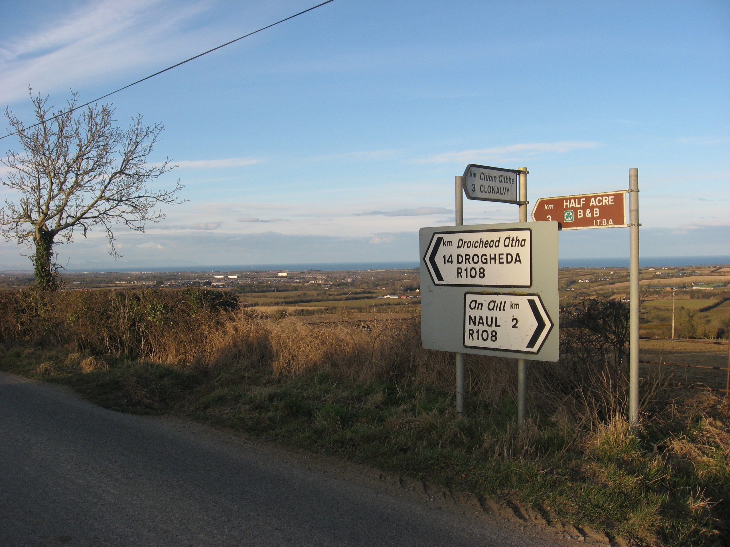
English: Signpost at Tullog, Co. Meath. The R108 road crosses the east end of Fourknocks ridge. Here it is the boundary between the townlands of Herbertstown and Tullog although the boundary on the 1836 O.S. map is shown one field further to the west. This point affords great views over east Co. Meath looking towards the sea 1764559. |
| Date | |
| Source | From geograph.org.uk |
| Author | Kieran Campbell |
| Attribution (required by the license) | Kieran Campbell / Signpost at Tullog, Co. Meath / |
| Camera location | | View this and other nearby images on: OpenStreetMap |
|---|
_heading:45.00&language=en)
| Object location | | View this and other nearby images on: OpenStreetMap |
|---|
_heading:45.00&language=en)
Licensing

|
This image was taken from the Geograph project collection. See this photograph's page on the Geograph website for the photographer's contact details. The copyright on this image is owned by Kieran Campbell and is licensed for reuse under the Creative Commons Attribution-ShareAlike 2.0 license.
|
This file is licensed under the Creative Commons Attribution-Share Alike 2.0 Generic license.
Attribution: Kieran Campbell
- You are free:
- to share – to copy, distribute and transmit the work
- to remix – to adapt the work
- Under the following conditions:
- attribution – You must give appropriate credit, provide a link to the license, and indicate if changes were made. You may do so in any reasonable manner, but not in any way that suggests the licensor endorses you or your use.
- share alike – If you remix, transform, or build upon the material, you must distribute your contributions under the same or compatible license as the original.
File history
Click on a date/time to view the file as it appeared at that time.
| Date/Time | Thumbnail | Dimensions | User | Comment | |
|---|---|---|---|---|---|
| current | 00:21, 6 March 2011 | | 2,816 × 2,112 (1.58 MB) | GeographBot | == {{int:filedesc}} == {{Information |description={{en|1=Signpost at Tullog, Co. Meath The R108 road crosses the east end of Fourknocks ridge. Here it is the boundary between the townlands of Herbertstown and Tullog although the boundary on the 1836 O.S. |
File usage
The following pages on the English Wikipedia use this file (pages on other projects are not listed):
Global file usage
The following other wikis use this file:
- Usage on ga.wikipedia.org
- Usage on www.wikidata.org