
File:Siege social upm.JPG
Size of this preview: 800 × 600 pixels. Other resolutions: 320 × 240 pixels | 640 × 480 pixels | 1,024 × 768 pixels | 1,280 × 960 pixels | 2,560 × 1,920 pixels | 4,320 × 3,240 pixels.
Original file (4,320 × 3,240 pixels, file size: 5.68 MB, MIME type: image/jpeg)
| This is a file from the Wikimedia Commons. Information from its description page there is shown below. Commons is a freely licensed media file repository. You can help. |
Summary
| Description |
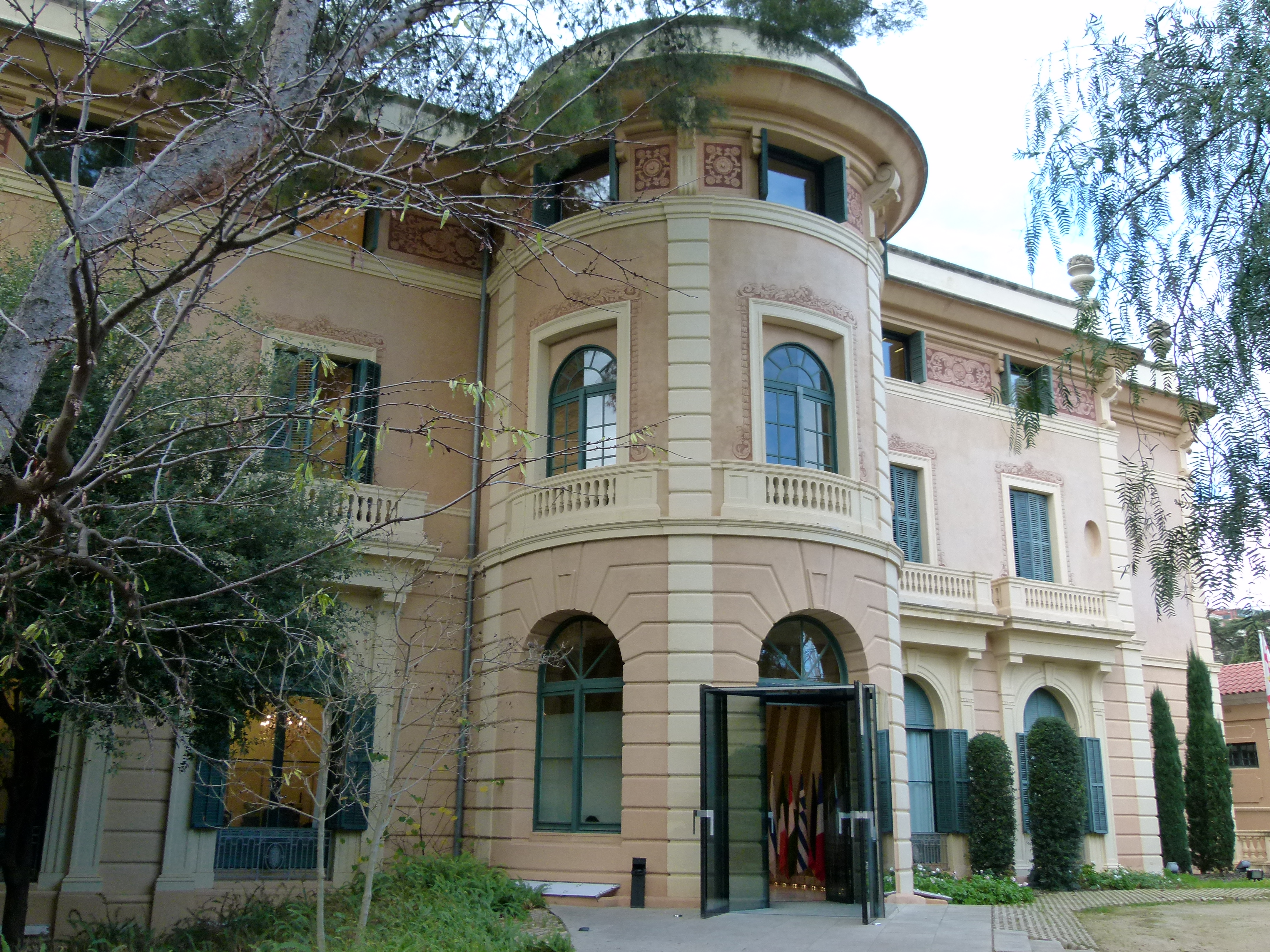
Español: Entrada a la sede central de la Unión por el Mediterráneo (UpM), en el Palacio de Pedralbes (Barcelona, España). Es la entrada situada en el extremo este del citado Palacio de Pedralbes, donde antes estaba la entrada privada de la Familia Real, y donde actualmente se encuentran las escaleras que llevan al secretariado de la UpM, en el segundo piso (antiguos aposentos de los infantes y del servicio). Puede observarse con facilidad que el estilo constructivo de las ventanas y la pintura, aquí es muy parecido al de la fachada principal del Palacio de Pedralbes. Actualmente, toda esta zona está sin embargo muy vallada, así que desde la fachada principal no es posible ver esta fachada lateral, a la que solamente es posible acceder por fuera si se rodea al edificio. |
| Date | |
| Source | Own work |
| Author | Beoptylk |
| Camera location | | View this and other nearby images on: OpenStreetMap |
|---|
Licensing
I, the copyright holder of this work, hereby publish it under the following license:
This file is licensed under the Creative Commons Attribution-Share Alike 4.0 International license.
- You are free:
- to share – to copy, distribute and transmit the work
- to remix – to adapt the work
- Under the following conditions:
- attribution – You must give appropriate credit, provide a link to the license, and indicate if changes were made. You may do so in any reasonable manner, but not in any way that suggests the licensor endorses you or your use.
- share alike – If you remix, transform, or build upon the material, you must distribute your contributions under the same or compatible license as the original.
File history
Click on a date/time to view the file as it appeared at that time.
| Date/Time | Thumbnail | Dimensions | User | Comment | |
|---|---|---|---|---|---|
| current | 11:40, 11 January 2016 | | 4,320 × 3,240 (5.68 MB) | Beoptylk | User created page with UploadWizard |
File usage
The following pages on the English Wikipedia use this file (pages on other projects are not listed):
Global file usage
The following other wikis use this file:
- Usage on de.wikipedia.org
- Usage on fr.wikipedia.org
- Usage on it.wikipedia.org