
File:Siege of Gravelines (Grevelingen) in 1644 (Atlas van Loon).jpg
Size of this preview: 741 × 600 pixels. Other resolutions: 297 × 240 pixels | 593 × 480 pixels | 949 × 768 pixels | 1,265 × 1,024 pixels | 2,531 × 2,048 pixels | 5,500 × 4,451 pixels.
Original file (5,500 × 4,451 pixels, file size: 3.11 MB, MIME type: image/jpeg)
| This is a file from the Wikimedia Commons. Information from its description page there is shown below. Commons is a freely licensed media file repository. You can help. |
_in_1644_(Atlas_van_Loon).jpg)
Summary
| Description |
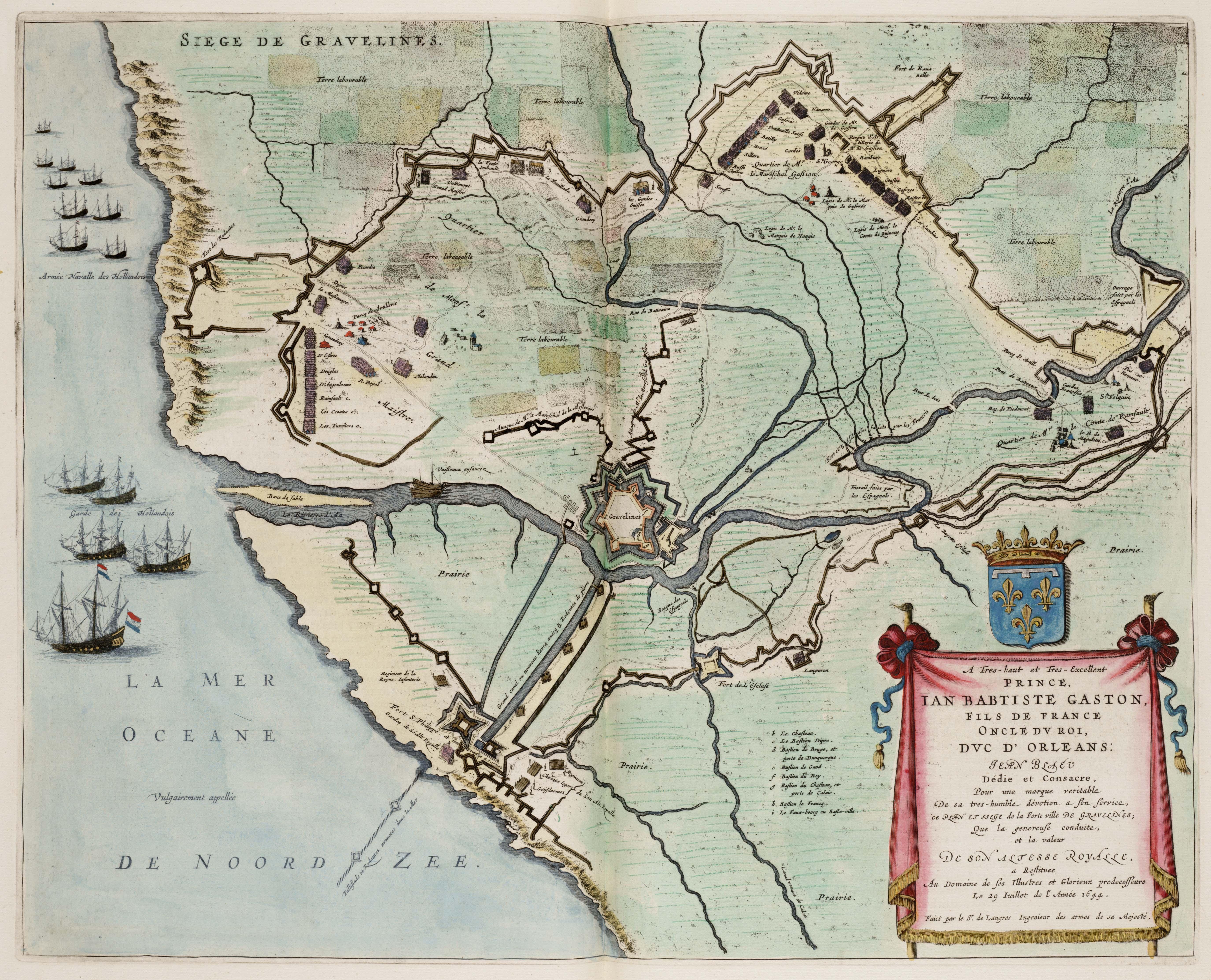
English: The siege of Gravelines (Grevelingen) in 1644 by the French.
Français : Atlas van Loon – Siège de Gravelines de 1644. |
| Date | |
| Source | Atlas van Loon |
| Author | Michael Florent van Langren |
| Camera location | | View this and other nearby images on: OpenStreetMap |
|---|
_in_1644_(Atlas_van_Loon).jpg¶ms=050.986608_N_0002.127731_E_globe:Earth_type:camera__&language=en)
Licensing
|
This work is in the public domain in its country of origin and other countries and areas where the copyright term is the author's life plus 100 years or fewer. | |
| This file has been identified as being free of known restrictions under copyright law, including all related and neighboring rights. | |
File history
Click on a date/time to view the file as it appeared at that time.
| Date/Time | Thumbnail | Dimensions | User | Comment | |
|---|---|---|---|---|---|
| current | 12:57, 20 December 2008 | | 5,500 × 4,451 (3.11 MB) | Kweniston | {{Information |Description={{en|1=The siege of Gravelines (Grevelingen) in 1644 by the French.}} |Source=Atlas van Loon |Author=Michael Florent van Langren |Date=1649 |Permission= |other_versions= }} <!--{{ImageUpload|full}}--> Category:1644 [[Catego |
File usage
The following pages on the English Wikipedia use this file (pages on other projects are not listed):
Global file usage
The following other wikis use this file:
- Usage on ca.wikipedia.org
- Usage on es.wikipedia.org
- Usage on fr.wikipedia.org
- Usage on nl.wikipedia.org
- Usage on oc.wikipedia.org
- Usage on ru.wikipedia.org
- Usage on uk.wikipedia.org
- Usage on vls.wikipedia.org
- Usage on www.wikidata.org
- Usage on zh.wikipedia.org
_in_1644_(Atlas_van_Loon).jpg)