
File:Scilly Isles Locator Map.png
Size of this preview: 360 × 599 pixels. Other resolutions: 144 × 240 pixels | 288 × 480 pixels | 1,000 × 1,665 pixels.
Original file (1,000 × 1,665 pixels, file size: 246 KB, MIME type: image/png)
| This is a file from the Wikimedia Commons. Information from its description page there is shown below. Commons is a freely licensed media file repository. You can help. |
Summary
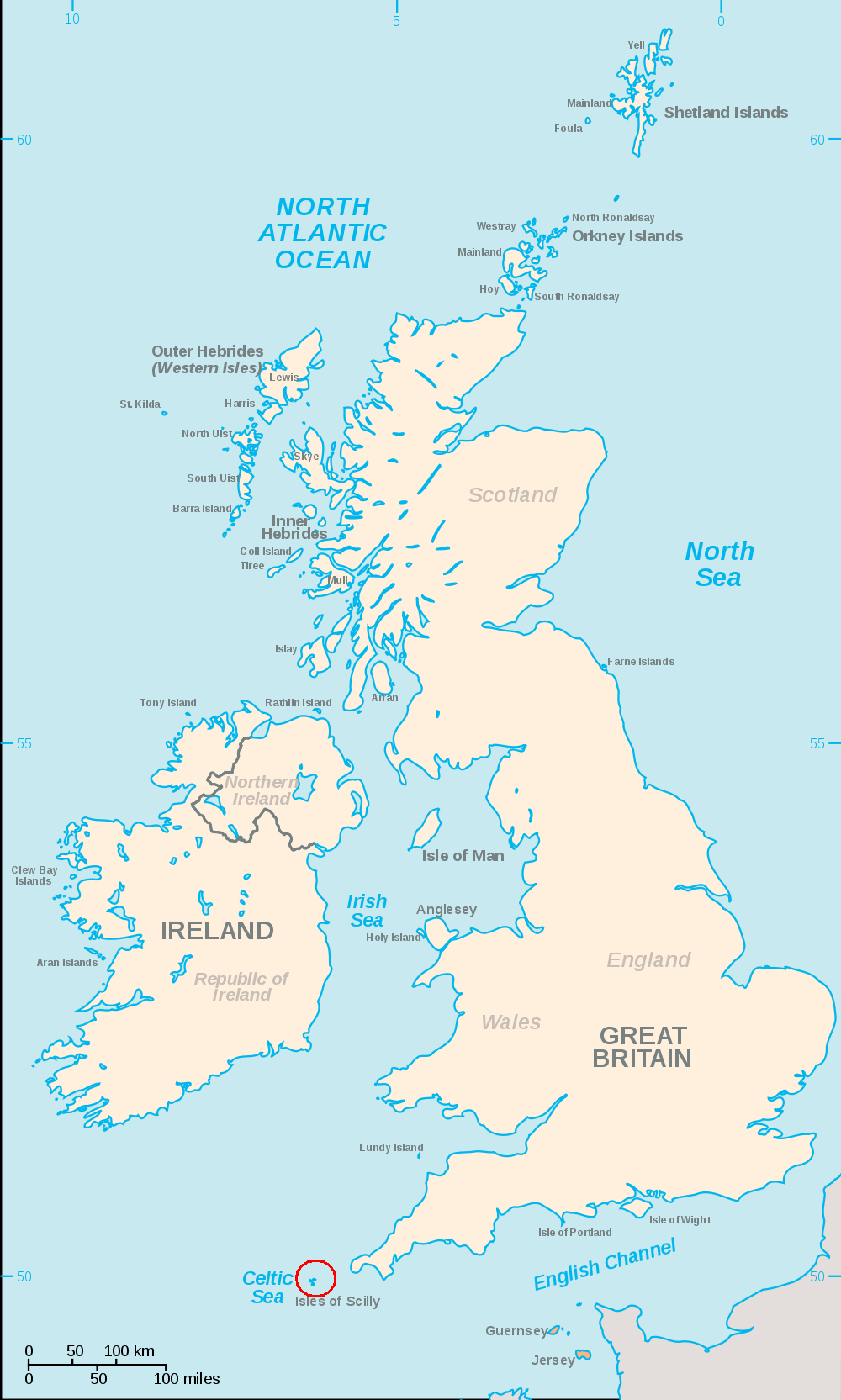
| Description | A map of the British Isles, with the largest islands and archipelagos labelled and a red circle around the County of the Scilly Isles.(Scilly Isles) |
| Date | |
| Source | File:British Isles.svg |
| Author | User:Smurrayinchester made original map, red circle added by Ruhrfisch (talk) |
| Other versions |
 |
Always considered part of the British Isles
Sometimes considered part of the British Isles
Other lands
Licensing
I, the copyright holder of this work, hereby publish it under the following license:

|
Permission is granted to copy, distribute and/or modify this document under the terms of the GNU Free Documentation License, Version 1.2 or any later version published by the Free Software Foundation; with no Invariant Sections, no Front-Cover Texts, and no Back-Cover Texts. A copy of the license is included in the section entitled GNU Free Documentation License. |
| This file is licensed under the Creative Commons Attribution-Share Alike 3.0 Unported license. | ||
| ||
| This licensing tag was added to this file as part of the GFDL licensing update. |
File history
Click on a date/time to view the file as it appeared at that time.
| Date/Time | Thumbnail | Dimensions | User | Comment | |
|---|---|---|---|---|---|
| current | 04:11, 18 September 2010 | | 1,000 × 1,665 (246 KB) | Ruhrfisch | == {{int:filedesc}} == {{Information |Description=An SVG map of the British Isles, with the largest islands and archipelagos labelled and a red circle around the Scilly Isles. |Source= File:British Isles.svg |Date= 2010-09 |Author= [[User:Smurrayinch |
File usage
The following pages on the English Wikipedia use this file (pages on other projects are not listed):
Global file usage
The following other wikis use this file:
- Usage on cs.wikipedia.org
- Usage on hy.wikipedia.org
- Usage on ja.wikipedia.org
- Usage on mk.wikipedia.org
- Usage on simple.wikipedia.org