
File:Schleienloecher2-1- C.jpg

Size of this preview: 800 × 435 pixels. Other resolutions: 320 × 174 pixels | 640 × 348 pixels | 1,024 × 557 pixels | 1,280 × 696 pixels | 3,008 × 1,635 pixels.
Original file (3,008 × 1,635 pixels, file size: 2.74 MB, MIME type: image/jpeg)
| This is a file from the Wikimedia Commons. Information from its description page there is shown below. Commons is a freely licensed media file repository. You can help. |
|

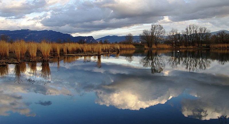
This image was selected as picture of the day on Wikimedia Commons for 28 September 2007. It was captioned as follows: English: The nature reserve Schleienlöcher in Hard, Austria. Other languages:
Čeština: Přírodní rezervace Schleienlöcher, Hard, Rakousko. English: The nature reserve Schleienlöcher in Hard, Austria. Euskara: Austriako Schleienlöcher erreserba naturala Magyar: Schleienlöcher természetvédelnmi terület az ausztriai Hard-ban Nederlands: Het natuurreservaat Schleienlöcher in Hard, Oostenrijk. 日本語: オーストリア、ハードのSchleienlöcher自然保護区 |
| Description |
Deutsch: Schilfrohr im Naturschutzgebiet Schleienlöcher in Hard (Vorarlberg) mit Blick zum Pfänder, zum Gebhardsberg und in den vorderen Bregenzerwald. Veröffentlicht: Georg Kessler in "Freizeit im Ländle, Die schönsten Ausflugziele in Vorarlberg ISBN 978-3-7022-3068-5 2010
English: The Schleienlöcher nature reserve in Hard (Austria) with view towards the Pfänder the Gebhardsberg and the Bregenzerwald.
Français : Réserve naturelle du Schleienlöcher dans la commune de Hard, en Autriche (Land de Vorarlberg). Les sommets visibles en arrière plan sont le Pfänder (dans les Alpes d'Allgäu, le Gebhardsberg et le Bregenzerwald.
Русский: Заповедник Шлейенлюхер в Гарде (Австрия) с видом на Пфюндер, Гебхардсберг и Брегензервальд. |
| Date | |
| Source | Own work |
| Author | Böhringer Friedrich – (slightly edited by Vassil) |
| Permission (Reusing this file) |
This file is licensed under the Creative Commons Attribution-Share Alike 2.5 Generic license.
|
| Other versions |
|


This Photo was taken by Böhringer Friedrich.
|
Feel free to use my photos, but please mention me as the author and if you want send me a message. or (rufre@lenz-nenning.at) |
| Camera location | | View this and other nearby images on: OpenStreetMap |
|---|
| Annotations | This image is annotated: View the annotations at Commons |
File history
Click on a date/time to view the file as it appeared at that time.
| Date/Time | Thumbnail | Dimensions | User | Comment | |
|---|---|---|---|---|---|
| current | 15:17, 5 July 2007 | | 3,008 × 1,635 (2.74 MB) | Vassil | {{Information |Description= |Source= |Date= |Author= |Permission= |other_versions= }} |
File usage
The following pages on the English Wikipedia use this file (pages on other projects are not listed):
Global file usage
The following other wikis use this file:
- Usage on ba.wikipedia.org
- Usage on bn.wikipedia.org
- Usage on de.wikipedia.org
- Usage on et.wikipedia.org
- Usage on fa.wikipedia.org
- Usage on hu.wikipedia.org
- Usage on it.wikipedia.org
- Usage on it.wikinews.org
- Usage on ko.wikipedia.org
- Usage on la.wikipedia.org
- Usage on mg.wikipedia.org
- Usage on os.wikipedia.org
- Usage on pl.wikipedia.org
- Usage on pt.wikipedia.org
- Usage on ru.wikipedia.org
- Usage on ru.wikinews.org
- Usage on uk.wikipedia.org
- Usage on vi.wikipedia.org
- Usage on zh.wikipedia.org