
File:Scherpenheuvel-ZichemLocatie.png
No higher resolution available.
Scherpenheuvel-ZichemLocatie.png (270 × 203 pixels, file size: 5 KB, MIME type: image/png)
| This is a file from the Wikimedia Commons. Information from its description page there is shown below. Commons is a freely licensed media file repository. You can help. |

|
This locator map image could be re-created using vector graphics as an SVG file. This has several advantages; see Commons:Media for cleanup for more information. If an SVG form of this image is available, please upload it and afterwards replace this template with
{{vector version available|new image name}}.
It is recommended to name the SVG file “Scherpenheuvel-ZichemLocatie.svg”—then the template Vector version available (or Vva) does not need the new image name parameter. |
Brezhoneg: Lec'hiañ Scherpenheuvel-Zichem (Belgia).
- from wikipedia-nl nl:Afbeelding:Scherpenheuvel-ZichemLocatie.png
- first upload 11 jan 2004 18:23 by nl:Gebruiker:LennartBolks
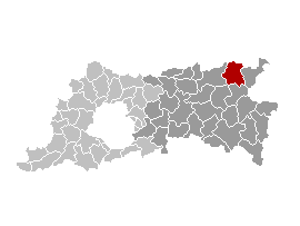
- description: Gemeentekaart, eigen werk
- created by nl:Gebruiker:LennartBolks and released into Public Domain
| This work has been released into the public domain by its author, LennartBolks. This applies worldwide. In some countries this may not be legally possible; if so: |
File history
Click on a date/time to view the file as it appeared at that time.
| Date/Time | Thumbnail | Dimensions | User | Comment | |
|---|---|---|---|---|---|
| current | 12:42, 12 April 2006 | | 270 × 203 (5 KB) | Profoss | |
| 22:33, 26 October 2005 |  | 270 × 203 (3 KB) | Cicero | *from wikipedia-nl nl:Afbeelding:Scherpenheuvel-ZichemLocatie.png *first upload 11 jan 2004 18:23 by nl:Gebruiker:LennartBolks *description: Gemeentekaart, eigen werk *created by nl:Gebruiker:LennartBolks and released into Public Domain {{P |
File usage
No pages on the English Wikipedia use this file (pages on other projects are not listed).