
File:Satellite image of Thomas Fire.jpg

Size of this preview: 548 × 600 pixels. Other resolutions: 219 × 240 pixels | 439 × 480 pixels | 702 × 768 pixels | 936 × 1,024 pixels | 1,872 × 2,048 pixels | 3,456 × 3,781 pixels.
Original file (3,456 × 3,781 pixels, file size: 1.88 MB, MIME type: image/jpeg)
| This is a file from the Wikimedia Commons. Information from its description page there is shown below. Commons is a freely licensed media file repository. You can help. |
Summary
| Description |
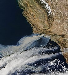
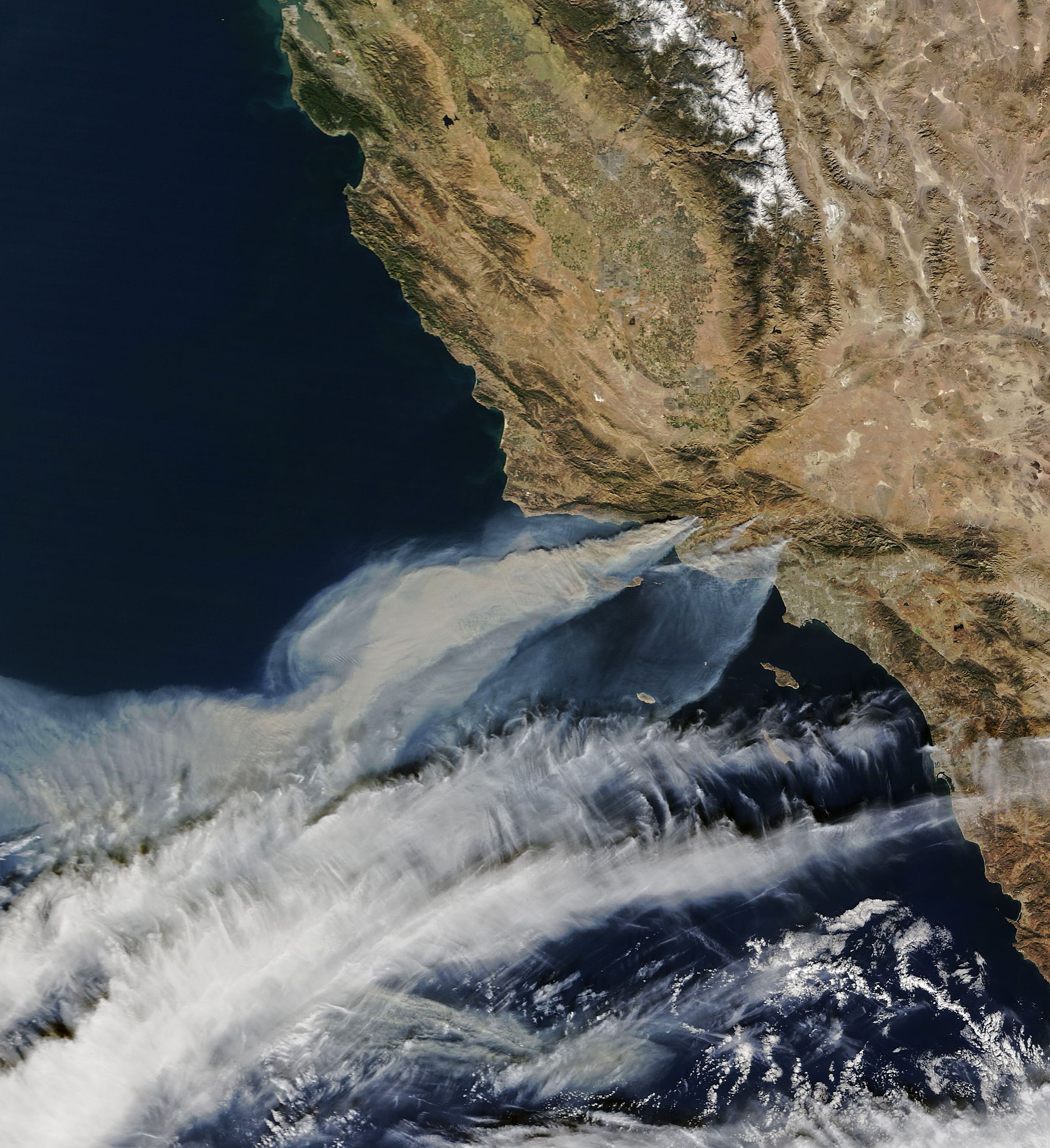
English: Satellite image from the Terra satellite of the smoke from the Thomas Fire in Ventura County, on December 5, along with the smoke from 2 other smaller fires, in Southern California. |
| Date | Taken on 5 December 2017, 10:52:11 |
| Source | https://earthobservatory.nasa.gov/NaturalHazards/view.php?id=91379 |
| Author |
NASA Earth Observatory images by Joshua Stevens, using MODIS data. Instrument(s): Terra - MODIS |
| Permission (Reusing this file) |
NASA |
Licensing
| This file is in the public domain in the United States because it was solely created by NASA. NASA copyright policy states that "NASA material is not protected by copyright unless noted". (See Template:PD-USGov, NASA copyright policy page or JPL Image Use Policy.) | ||
 |
Warnings:
|
File history
Click on a date/time to view the file as it appeared at that time.
| Date/Time | Thumbnail | Dimensions | User | Comment | |
|---|---|---|---|---|---|
| current | 07:15, 6 December 2017 | | 3,456 × 3,781 (1.88 MB) | FriarTuck1981 | Reverted to version as of 07:13, 6 December 2017 (UTC) |
| 07:14, 6 December 2017 |  | 4,879 × 5,338 (2.3 MB) | FriarTuck1981 | Reverted to version as of 07:11, 6 December 2017 (UTC) | |
| 07:13, 6 December 2017 |  | 3,456 × 3,781 (1.88 MB) | FriarTuck1981 | cropped photo | |
| 07:11, 6 December 2017 |  | 4,879 × 5,338 (2.3 MB) | FriarTuck1981 | User created page with UploadWizard |
File usage
The following pages on the English Wikipedia use this file (pages on other projects are not listed):
Global file usage
The following other wikis use this file:
- Usage on ar.wikipedia.org
- Usage on cs.wikipedia.org
- Usage on es.wikinews.org
- Usage on fa.wikipedia.org
- Usage on ms.wikipedia.org
- Usage on vi.wikipedia.org
- Usage on www.wikidata.org
- Usage on zh.wikipedia.org