
File:Sandy Creek, Texas (present-day Leesville) in 1839.jpg

No higher resolution available.
Sandy_Creek,_Texas_(present-day_Leesville)_in_1839.jpg (317 × 214 pixels, file size: 24 KB, MIME type: image/jpeg)
| This is a file from the Wikimedia Commons. Information from its description page there is shown below. Commons is a freely licensed media file repository. You can help. |
_in_1839.jpg)
Summary
| Description |
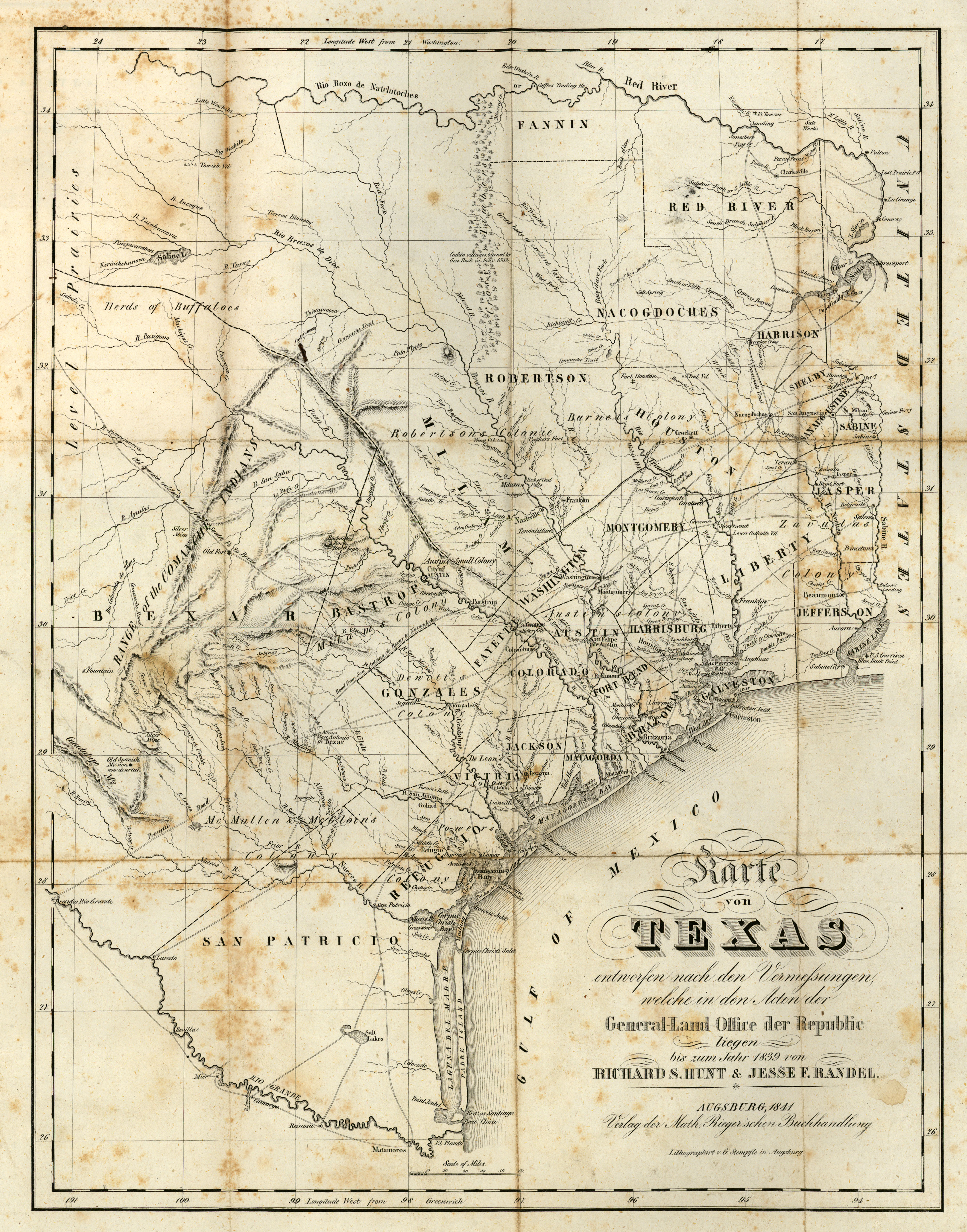
English: Sandy Creek, Texas (present-day Leesville) in 1839 |
| Date | |
| Source |
http://legacy.lib.utexas.edu/maps/historical/scherpf-texas-1841.jpg http://legacy.lib.utexas.edu/maps/historical/history_texas.html |
| Author | "Karte von Texas entworfen nach den Vermessungen, welche in den Acten der General-Land-Office der Republic liegen bis zum Jahr 1839 von Richard S. Hunt & Jesse F. Randel". From George A. Scherpf, "Entstehungsgeschichte und gegenwärtiger Zustand des neuen, unabhängigen, amerikanischen Staates Texas. Ein Beitrag zur Geschichte, Statistik und Geographie dieses Jahrhunderts, Im Lande selbst gesammelt von G. A. Scherpf. Mit zwei Karten, von Texas, Rio Grande und dem West-Land am Stillen Ocean". Reduced version of Hunt and Randel’s 1839 map of Texas. One of the earliest representations on a printed map of the newly established town of Austin (1839). Augsburg: Verlag der Matth. Rieger’schen Buchhandlung, 1841. |
Licensing
|
This work is in the public domain in its country of origin and other countries and areas where the copyright term is the author's life plus 70 years or fewer. This work is in the public domain in the United States because it was published (or registered with the U.S. Copyright Office) before January 1, 1929. | |
| This file has been identified as being free of known restrictions under copyright law, including all related and neighboring rights. | |
File history
Click on a date/time to view the file as it appeared at that time.
| Date/Time | Thumbnail | Dimensions | User | Comment | |
|---|---|---|---|---|---|
| current | 02:10, 1 April 2021 | | 317 × 214 (24 KB) | LubysBluePlate | Uploaded a work by "Karte von Texas entworfen nach den Vermessungen, welche in den Acten der General-Land-Office der Republic liegen bis zum Jahr 1839 von Richard S. Hunt & Jesse F. Randel". From George A. Scherpf, "Entstehungsgeschichte und gegenwärtiger Zustand des neuen, unabhängigen, amerikanischen Staates Texas. Ein Beitrag zur Geschichte, Statistik und Geographie dieses Jahrhunderts, Im Lande selbst gesammelt von G. A. Scherpf. Mit zwei Karten, von Texas, Rio Grande und dem West-Land am... |
File usage
The following pages on the English Wikipedia use this file (pages on other projects are not listed):
_in_1839.jpg)