
File:Saldanha Bay WW.jpg

Size of this preview: 750 × 600 pixels. Other resolutions: 300 × 240 pixels | 600 × 480 pixels | 960 × 768 pixels | 1,280 × 1,024 pixels.
Original file (1,280 × 1,024 pixels, file size: 933 KB, MIME type: image/jpeg)
| This is a file from the Wikimedia Commons. Information from its description page there is shown below. Commons is a freely licensed media file repository. You can help. |
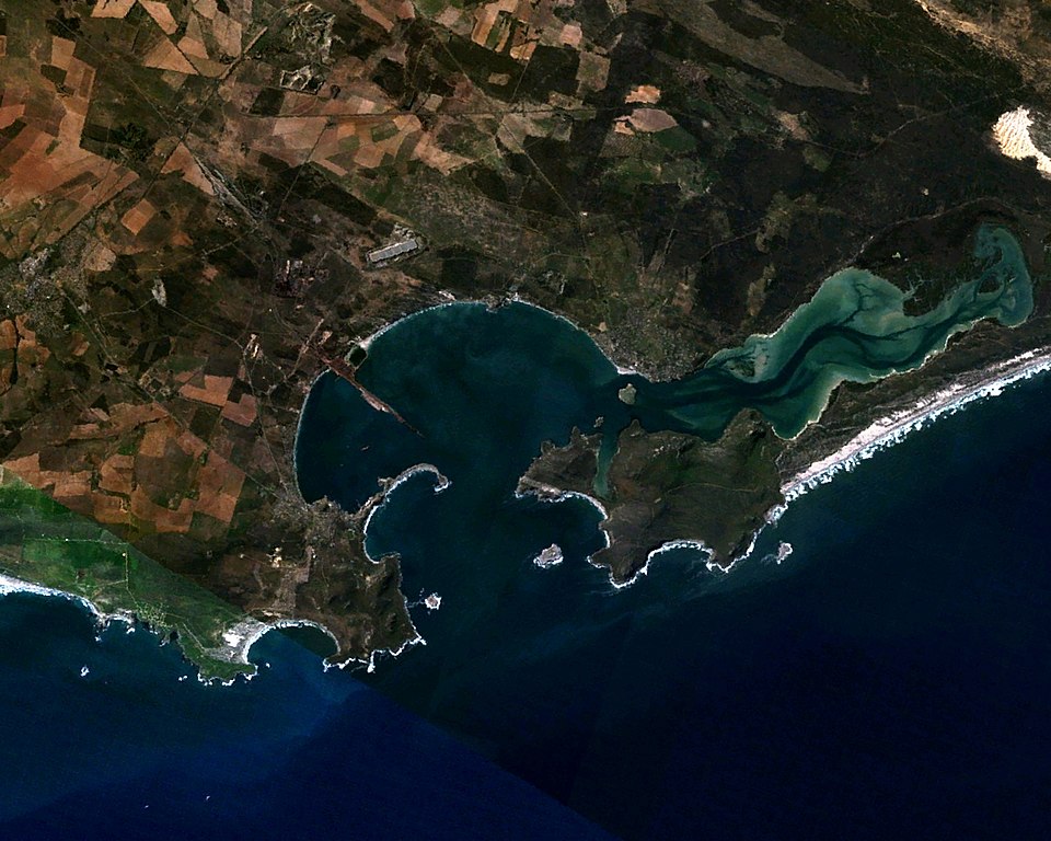
| Description | Saldanha Bay, Western Cape, South Africa. Coordinates: 33º 02' 11" S 17º 59' 04" E. Facing east (north is to the left.) |
| Date | |
| Source | Made with The GIMP! from a NASA World Wind screenshot |
| Author | Júlio Reis (User:Tintazul) |
| Permission (Reusing this file) |
I, the author release this image into Public Domain. |
| This image is in the public domain because it is a screenshot from NASA’s globe software World Wind using a public domain layer, such as Blue Marble, MODIS, Landsat, SRTM, USGS or GLOBE.
|
 |
File history
Click on a date/time to view the file as it appeared at that time.
| Date/Time | Thumbnail | Dimensions | User | Comment | |
|---|---|---|---|---|---|
| current | 23:33, 5 November 2005 | | 1,280 × 1,024 (933 KB) | Tintazul | {{Information| |Description=Saldanha Bay, Western Cape, South Africa. Coordinates: 33º 02' 11" S 17º 59' 04" E. Facing east (north is to the left.) |Source=Made with [http://www.gimp.org/ The GIMP!] from a [http://worldwind.arc.nasa.gov/ NASA World Wind |
File usage
The following pages on the English Wikipedia use this file (pages on other projects are not listed):
Global file usage
The following other wikis use this file:
- Usage on af.wikipedia.org
- Usage on ceb.wikipedia.org
- Usage on de.wikipedia.org
- Usage on eo.wikipedia.org
- Usage on es.wikipedia.org
- Usage on fi.wikipedia.org
- Usage on fr.wikipedia.org
- Usage on it.wikipedia.org
- Usage on nl.wikipedia.org
- Usage on pt.wikipedia.org
- Usage on ru.wikipedia.org
- Usage on www.wikidata.org
- Usage on zh.wikipedia.org