
File:SO2 concentration after Mount Agung eruption.png
Size of this preview: 800 × 450 pixels. Other resolutions: 320 × 180 pixels | 640 × 360 pixels | 1,024 × 576 pixels | 1,280 × 720 pixels | 1,920 × 1,080 pixels.
Original file (1,920 × 1,080 pixels, file size: 205 KB, MIME type: image/png)
| This is a file from the Wikimedia Commons. Information from its description page there is shown below. Commons is a freely licensed media file repository. You can help. |
Summary
| Description |
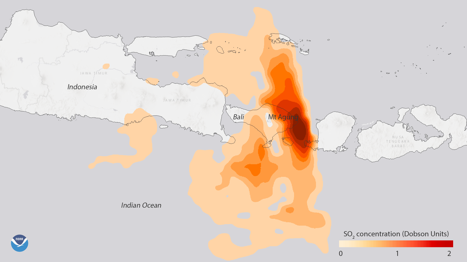
English: Data from NASA’s Aura satellite shows the high sulfur dioxide (SO2) concentrations associated with the volcanic eruption of Mount Agung in eastern Bali, Indonesia, on Monday, November 27, 2017. Prior to and during eruptions, volcanoes like Mount Agung release large amounts of SO2 into the atmosphere, which can act as an early warning. After being released, SO2 can be transformed into tiny sulfate aerosol particles, where they can alter the brightness of clouds and affect regional precipitation patterns. |
| Date | |
| Source | https://www.nesdis.noaa.gov/content/mount-agung-erupts-bali-indonesia |
| Author | NOAA NESDIS |
Licensing
This image is in the public domain because it contains materials that originally came from the U.S. National Oceanic and Atmospheric Administration, taken or made as part of an employee's official duties.
|
File history
Click on a date/time to view the file as it appeared at that time.
| Date/Time | Thumbnail | Dimensions | User | Comment | |
|---|---|---|---|---|---|
| current | 06:04, 13 May 2018 | | 1,920 × 1,080 (205 KB) | A1Cafel | User created page with UploadWizard |
File usage
The following pages on the English Wikipedia use this file (pages on other projects are not listed):