
File:Russia Khabarovsk Krai location map.svg

Size of this PNG preview of this SVG file: 365 × 599 pixels. Other resolutions: 146 × 240 pixels | 292 × 480 pixels | 468 × 768 pixels | 624 × 1,024 pixels | 1,247 × 2,048 pixels | 636 × 1,044 pixels.
Original file (SVG file, nominally 636 × 1,044 pixels, file size: 179 KB)
| This is a file from the Wikimedia Commons. Information from its description page there is shown below. Commons is a freely licensed media file repository. You can help. |
Summary
| Description |
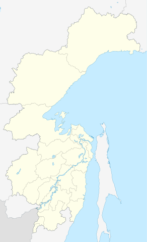
English: Khabarovsk Krai location map
Equirectangular projection, N/S stretching 174 %. True scale parallel: 55°00' N. Geographic limits of the map:
|
| Date | |
| Source | Own work |
| Author | Das steinerne Herz |
Licensing
I, the copyright holder of this work, hereby publish it under the following license:
This file is licensed under the Creative Commons Attribution-Share Alike 3.0 Unported license.
- You are free:
- to share – to copy, distribute and transmit the work
- to remix – to adapt the work
- Under the following conditions:
- attribution – You must give appropriate credit, provide a link to the license, and indicate if changes were made. You may do so in any reasonable manner, but not in any way that suggests the licensor endorses you or your use.
- share alike – If you remix, transform, or build upon the material, you must distribute your contributions under the same or compatible license as the original.
File history
Click on a date/time to view the file as it appeared at that time.
| Date/Time | Thumbnail | Dimensions | User | Comment | |
|---|---|---|---|---|---|
| current | 11:32, 5 July 2011 | | 636 × 1,044 (179 KB) | Das steinerne Herz |
File usage
The following pages on the English Wikipedia use this file (pages on other projects are not listed):
- 147 km
- 18 km, Khabarovsk Krai
- 2014 Winter Olympics torch relay
- 24 km
- 34 kilometr
- 43 kilometr
- 52 kilometr
- Amursk
- Avan, Khabarovsk Krai
- Ayan, Russia
- Belichy Island
- Bikin
- Bogorodskoye Airport
- Bolshoy Shantar Island
- Cape Bersen'yeva
- Chastye Islands
- Chekunda
- Chumikan
- De-Kastri
- Duga radar
- Dusse-Alin Tunnel
- Dzhigda
- Dzyomgi Airport
- Far Eastern Federal District
- Feklistova Island
- Gorin (air base)
- Imeni Poliny Osipenko (rural locality)
- Kalinka Airfield
- Kamenny Ruchey
- Khabarovsk
- Khabarovsk Novy Airport
- Khabarovsk Tsentralny
- Komsomolsk-on-Amur
- Komsomolsk-on-Amur Airport
- Kondyor Massif
- Kusova
- Kuznetsovsky Tunnel
- Lazarev (urban-type settlement)
- Maly Shantar Island
- Medvezhy Island
- Mengon (air base)
- Menshikov Island
- Nikolayevsk-on-Amur
- Nikolayevsk-on-Amur Airport
- Okhotsk
- Oremif
- Pivan-1
- Postovaya (air base)
- Prokofyeva Island
- Ptichy Island (Shantar Islands)
- Reyneke Island (Sea of Okhotsk)
- Sakharnaya Golova Island
- Selikhino
- Sivuch'i Rocks
- Snowflake (prison)
- Solnechny, Khabarovsk Krai
- Sovetskaya Gavan
- Vanino, Khabarovsk Krai
- Verino airfield
- Vyazemsky, Khabarovsk Krai
- Module:Location map/data/Russia Khabarovsk Krai
- Module:Location map/data/Russia Khabarovsk Krai/doc
Global file usage
The following other wikis use this file:
- Usage on af.wikipedia.org
- Usage on ar.wikipedia.org
- Usage on azb.wikipedia.org
- Usage on az.wikipedia.org
- Usage on be.wikipedia.org
- Савецкая Гавань
- Вяземскі (горад)
- Бікін (горад)
- Амурск
- Шаблон:На карце/Расія Хабараўскі край
- Эльбан
- Чумікан
- Ваніна
- Пераяслаўка
- Хор (Хабараўскі край)
- Сонечны (Хабараўскі край)
- Чэгдамын
- Ахоцк
- Аян (Хабараўскі край)
- Багародскае (Хабараўскі край)
- Троіцкае (Хабараўскі край)
- Казакевічава
- Новы Ургал
- Высакагорны (Хабараўскі край)
- Ягадны (Хабараўскі край)
- Usage on bg.wikipedia.org
- Usage on ceb.wikipedia.org
- Usage on ce.wikipedia.org
- Хабаровск
- Амур-тӀера-Комсомольск
- Амурск
- Корфовски
- Виноградовка (Хабаровскан кӀошт)
- Константиновка (Хабаровскан кӀошт)
- Новотроицки (Хабаровскан кӀошт)
- Заозёрни (Хабаровскан мохк)
- 18 км (Хабаровскан мохк)
- Лесни (Хабаровскан мохк)
- Благодатни (Хабаровскан мохк)
- Чистополье (Хабаровскан мохк)
- Восточни (Хабаровскан мохк)
- Ракитни (Хабаровскан мохк)
- Мирни (Хабаровскан мохк)
- Краснореченски (Хабаровскан мохк)
- Кеп:Меттиган карта Росси Хабаровскан мохк
- Таёжни (Хабаровскан мохк)
- 24 км (Хабаровскан мохк)
- Чернолесье (Хабаровскан мохк)
- Малышево (Хабаровскан мохк)
- Чирки (Хабаровскан мохк)
View more global usage of this file.