
File:Map of Rotterdam by Joan Blaeu 1649.jpg

Size of this preview: 738 × 600 pixels. Other resolutions: 295 × 240 pixels | 591 × 480 pixels | 945 × 768 pixels | 1,260 × 1,024 pixels | 2,519 × 2,048 pixels | 5,500 × 4,471 pixels.
Original file (5,500 × 4,471 pixels, file size: 4.2 MB, MIME type: image/jpeg)
| This is a file from the Wikimedia Commons. Information from its description page there is shown below. Commons is a freely licensed media file repository. You can help. |
Summary
| Description |
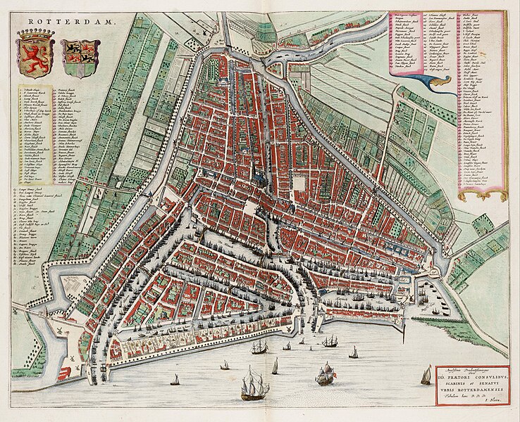
English: Map of Rotterdam in the Netherlands by Joan Blaeu, 1649.
Nederlands: Plattegrond van Rotterdam door Joan Blaeu, 1649. |
||||||||||||||||||||||||||
| Date | |||||||||||||||||||||||||||
| Source | Atlas van Loon | ||||||||||||||||||||||||||
| Author |
|
||||||||||||||||||||||||||
| Other versions |
|
||||||||||||||||||||||||||
.jpg)


Licensing
|
This work is in the public domain in its country of origin and other countries and areas where the copyright term is the author's life plus 100 years or fewer. | |
| This file has been identified as being free of known restrictions under copyright law, including all related and neighboring rights. | |
File history
Click on a date/time to view the file as it appeared at that time.
| Date/Time | Thumbnail | Dimensions | User | Comment | |
|---|---|---|---|---|---|
| current | 16:38, 13 April 2009 | | 5,500 × 4,471 (4.2 MB) | OldMaps | {{Information |Description={{en|1=Map of Rotterdam in the Netherlands by Joan Blaeu, 1649}} {{nl|1=Plattegrond van Rotterdam door Joan Blaeu, 1649}} |Source=Atlas van Loon |Author=Joan Blaeu |Date=1649 |Permission= |other_versions= }} <!--{{ImageUpload|f |
File usage
The following pages on the English Wikipedia use this file (pages on other projects are not listed):
Global file usage
The following other wikis use this file:
- Usage on fr.wikipedia.org