
File:Rothesay Castle - Gatehouse and Pigeon Tower 2016.jpg

Size of this preview: 800 × 518 pixels. Other resolutions: 320 × 207 pixels | 640 × 415 pixels | 1,024 × 664 pixels | 1,280 × 829 pixels | 2,560 × 1,659 pixels | 4,452 × 2,885 pixels.
Original file (4,452 × 2,885 pixels, file size: 6.09 MB, MIME type: image/jpeg)
| This is a file from the Wikimedia Commons. Information from its description page there is shown below. Commons is a freely licensed media file repository. You can help. |
Summary
| Description |
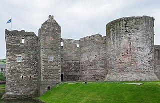
English: Rothesay Castle, Isle of Bute. Showing the Gatehouse and the Pigeon Tower. |
| Date | |
| Source | Own work |
| Author | DeFacto |
| Camera location | | View this and other nearby images on: OpenStreetMap |
|---|
Licensing
I, the copyright holder of this work, hereby publish it under the following license:
This file is licensed under the Creative Commons Attribution-Share Alike 4.0 International license.
- You are free:
- to share – to copy, distribute and transmit the work
- to remix – to adapt the work
- Under the following conditions:
- attribution – You must give appropriate credit, provide a link to the license, and indicate if changes were made. You may do so in any reasonable manner, but not in any way that suggests the licensor endorses you or your use.
- share alike – If you remix, transform, or build upon the material, you must distribute your contributions under the same or compatible license as the original.

|
This image has been assessed under the valued image criteria and is considered the most valued image on Commons within the scope: Gatehouse and Pigeon Tower of Rothesay Castle - from the north-west. You can see its nomination here. |
This image has been assessed using the Quality image guidelines and is considered a Quality image.
|
File history
Click on a date/time to view the file as it appeared at that time.
| Date/Time | Thumbnail | Dimensions | User | Comment | |
|---|---|---|---|---|---|
| current | 12:38, 5 December 2020 | | 4,452 × 2,885 (6.09 MB) | DeFacto | Perspective, exposure and crop adjusted |
| 18:08, 16 July 2016 |  | 4,452 × 2,885 (6.07 MB) | DeFacto | User created page with UploadWizard |
File usage
The following pages on the English Wikipedia use this file (pages on other projects are not listed):
Global file usage
The following other wikis use this file:
- Usage on da.wikipedia.org
- Usage on ru.wikipedia.org
- Usage on sco.wikipedia.org
- Usage on zh.wikipedia.org