
File:Rotherham Road railway station (site), Yorkshire (geograph 6537174).jpg
Size of this preview: 800 × 600 pixels. Other resolutions: 320 × 240 pixels | 640 × 480 pixels | 1,024 × 768 pixels | 1,280 × 960 pixels | 1,600 × 1,200 pixels.
Original file (1,600 × 1,200 pixels, file size: 687 KB, MIME type: image/jpeg)
| This is a file from the Wikimedia Commons. Information from its description page there is shown below. Commons is a freely licensed media file repository. You can help. |
,_Yorkshire_(geograph_6537174).jpg)
Summary
| Description |
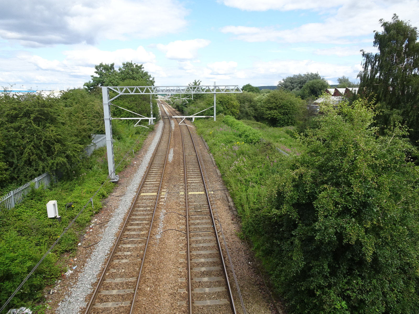
English: Rotherham Road railway station (site), Yorkshire Opened in 1871 as "Park Gate" by the Manchester Sheffield & Lincolnshire Railway, which later changed its name to the Great Central Railway, on the line from Rotherham Central to Doncaster. This station's name was changed to "Rotherham Road" in 1895. It closed to passengers in 1953. View north east towards Parkgate & Aldwarke and Doncaster. The north-east end of the 2 parallel platforms would have been immediately below the camera position but the modern Rotherham Road bridge has been built right over the top of where the station building would have been. The line was electrified in 2018 for use by the South Yorkshire Supertram which now shares the line. |
| Date | |
| Source | From geograph.org.uk |
| Author | Nigel Thompson |
| Permission (Reusing this file) |
Creative Commons Attribution Share-alike license 2.0 |
| Attribution (required by the license) | Nigel Thompson / Rotherham Road railway station (site), Yorkshire / |
| Camera location | | View this and other nearby images on: OpenStreetMap |
|---|
,_Yorkshire_(geograph_6537174).jpg¶ms=053.441096_N_-001.350366_E_globe:Earth_type:camera_source:geograph-osgb36(SK43259401)_heading:67.00&language=en)
| Object location | | View this and other nearby images on: OpenStreetMap |
|---|
,_Yorkshire_(geograph_6537174).jpg¶ms=053.441180_N_-001.349610_E_globe:Earth_class:object_type:object_source:geograph-osgb36(SK43309402)_heading:67.00&language=en)
Licensing

|
This image was taken from the Geograph project collection. See this photograph's page on the Geograph website for the photographer's contact details. The copyright on this image is owned by Nigel Thompson and is licensed for reuse under the Creative Commons Attribution-ShareAlike 2.0 license.
|
This file is licensed under the Creative Commons Attribution-Share Alike 2.0 Generic license.
Attribution: Nigel Thompson
- You are free:
- to share – to copy, distribute and transmit the work
- to remix – to adapt the work
- Under the following conditions:
- attribution – You must give appropriate credit, provide a link to the license, and indicate if changes were made. You may do so in any reasonable manner, but not in any way that suggests the licensor endorses you or your use.
- share alike – If you remix, transform, or build upon the material, you must distribute your contributions under the same or compatible license as the original.
File history
Click on a date/time to view the file as it appeared at that time.
| Date/Time | Thumbnail | Dimensions | User | Comment | |
|---|---|---|---|---|---|
| current | 10:27, 29 July 2020 | | 1,600 × 1,200 (687 KB) | Lamberhurst | Transferred from geograph.co.uk using [https://tools.wmflabs.org/geograph2commons/ geograph2commons] |
File usage
The following pages on the English Wikipedia use this file (pages on other projects are not listed):
,_Yorkshire_(geograph_6537174).jpg)