
File:Roman Empire with praetorian prefectures in 400 AD.png

Size of this preview: 800 × 551 pixels. Other resolutions: 320 × 221 pixels | 640 × 441 pixels | 1,024 × 706 pixels | 1,280 × 882 pixels | 2,052 × 1,414 pixels.
Original file (2,052 × 1,414 pixels, file size: 157 KB, MIME type: image/png)
| This is a file from the Wikimedia Commons. Information from its description page there is shown below. Commons is a freely licensed media file repository. You can help. |
Summary
| Description |
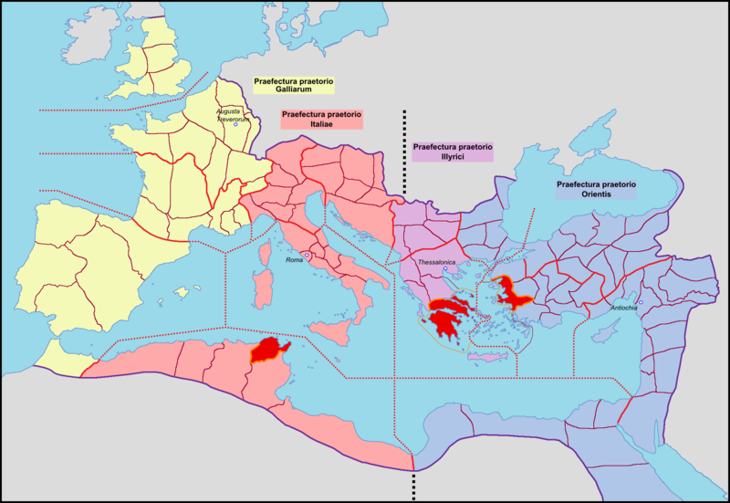
English: Map of the Roman Empire in praetorian prefectures, in AD 400, with an unlikely treatment of the British provinces.
Français : Carte de l'Empire romain avec ses préfectures du prétoire, en 400 après J.-C. |
| Date | 04/03/09 |
| Source | Own work |
| Author | Mandrak |
| Other versions |
Praetorian prefectures
Dioceses
|


_locator_map.png)
_locator_map.png)


Licensing
| I, the copyright holder of this work, release this work into the public domain. This applies worldwide. In some countries this may not be legally possible; if so: I grant anyone the right to use this work for any purpose, without any conditions, unless such conditions are required by law. |
| Annotations | This image is annotated: View the annotations at Commons |
File history
Click on a date/time to view the file as it appeared at that time.
| Date/Time | Thumbnail | Dimensions | User | Comment | |
|---|---|---|---|---|---|
| current | 12:58, 4 March 2009 | | 2,052 × 1,414 (157 KB) | Mandrak | {{Information |Description={{en|1=Map of the Roman Empire with praetorian prefectures, in 400 AD.}} {{fr|1=Carte de l'Empire romain avec ses préfectures du prétoire, en 400 après J.-C.}} |Source=travail personnel (own work) |Author=[[User:Mandrak|Mandr |
File usage
The following pages on the English Wikipedia use this file (pages on other projects are not listed):
Global file usage
The following other wikis use this file:
- Usage on ar.wikipedia.org
- Usage on be.wikipedia.org
- Usage on bg.wikipedia.org
- Usage on el.wikipedia.org
- Usage on eo.wikipedia.org
- Usage on fi.wikipedia.org
- Usage on fr.wikipedia.org
- Usage on it.wikipedia.org
- Usage on lt.wikipedia.org
- Usage on nl.wikipedia.org
- Usage on pt.wikipedia.org
- Usage on ru.wikipedia.org
- Usage on sl.wikipedia.org