
File:RomanItaly.png
Size of this preview: 487 × 600 pixels. Other resolutions: 195 × 240 pixels | 390 × 480 pixels | 720 × 887 pixels.
Original file (720 × 887 pixels, file size: 361 KB, MIME type: image/png)
| This is a file from the Wikimedia Commons. Information from its description page there is shown below. Commons is a freely licensed media file repository. You can help. |
Summary
| Description |
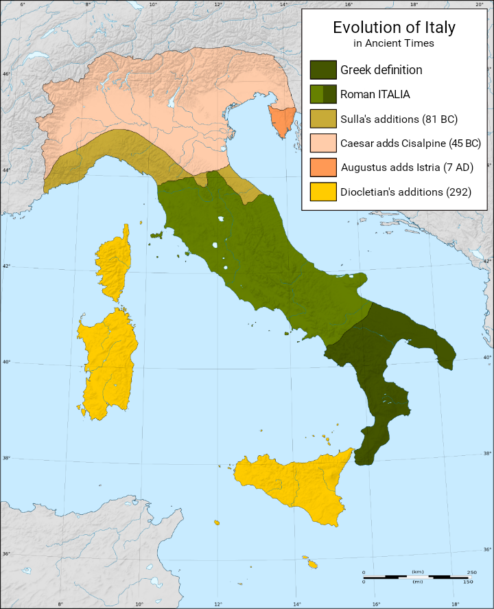
Italiano: Evoluzione geografica dell'Italia nel periodo Romano [1] |
| Date | |
| Source | Own work |
| Author | GaiusCrastinus |
| Other versions | Derivative works of this file: RomanItaly.svg |
Licensing
I, the copyright holder of this work, hereby publish it under the following licenses:
This file is licensed under the Creative Commons Attribution-Share Alike 3.0 Unported license.
- You are free:
- to share – to copy, distribute and transmit the work
- to remix – to adapt the work
- Under the following conditions:
- attribution – You must give appropriate credit, provide a link to the license, and indicate if changes were made. You may do so in any reasonable manner, but not in any way that suggests the licensor endorses you or your use.
- share alike – If you remix, transform, or build upon the material, you must distribute your contributions under the same or compatible license as the original.

|
Permission is granted to copy, distribute and/or modify this document under the terms of the GNU Free Documentation License, Version 1.2 or any later version published by the Free Software Foundation; with no Invariant Sections, no Front-Cover Texts, and no Back-Cover Texts. A copy of the license is included in the section entitled GNU Free Documentation License. |
You may select the license of your choice.
File history
Click on a date/time to view the file as it appeared at that time.
| Date/Time | Thumbnail | Dimensions | User | Comment | |
|---|---|---|---|---|---|
| current | 13:43, 15 October 2021 | | 720 × 887 (361 KB) | Foghe | Removed San Marino; legend. |
| 11:09, 27 December 2020 |  | 720 × 887 (388 KB) | Nick.mon | Reverted to version as of 08:45, 23 August 2018 (UTC) Upload another image, this is a complete different one; thank you | |
| 07:37, 20 May 2020 |  | 1,359 × 1,920 (1.27 MB) | Barjimoa | ||
| 08:45, 23 August 2018 |  | 720 × 887 (388 KB) | Barjimoa | Malta | |
| 10:27, 7 July 2018 |  | 720 × 887 (389 KB) | Barjimoa | ||
| 07:46, 20 January 2018 |  | 720 × 887 (389 KB) | Barjimoa | Minor adjustment | |
| 07:45, 20 January 2018 |  | 720 × 887 (389 KB) | Barjimoa | English version | |
| 20:35, 21 April 2010 |  | 1,240 × 1,472 (1.66 MB) | GaiusCrastinus | new version Category:Maps of Italy | |
| 10:28, 30 June 2009 |  | 1,240 × 1,472 (160 KB) | GaiusCrastinus | 212--->292 | |
| 16:26, 29 June 2009 |  | 1,240 × 1,472 (160 KB) | GaiusCrastinus | corrections |
File usage
The following pages on the English Wikipedia use this file (pages on other projects are not listed):
Global file usage
The following other wikis use this file:
- Usage on gl.wikipedia.org
- Usage on it.wikipedia.org
- Usage on ja.wikipedia.org
- Usage on pt.wikipedia.org
- Usage on tr.wikipedia.org
- Usage on uk.wikipedia.org