
File:Rivers of Armenia.jpg

Size of this preview: 618 × 599 pixels. Other resolutions: 248 × 240 pixels | 495 × 480 pixels | 792 × 768 pixels | 1,056 × 1,024 pixels | 1,437 × 1,393 pixels.
Original file (1,437 × 1,393 pixels, file size: 182 KB, MIME type: image/jpeg)
| This is a file from the Wikimedia Commons. Information from its description page there is shown below. Commons is a freely licensed media file repository. You can help. |
Summary
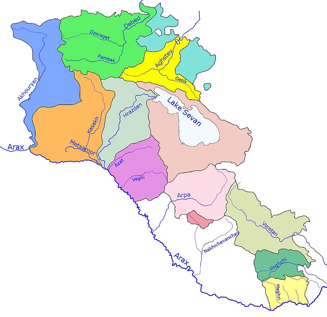
| Description | Map of the Rivers of Armenia — in Western Asia. |
| Date | |
| Source | http://en.wikipedia.org/wiki/Image:Rivers_of_Armenia.jpeg |
| Author | en:User:Fhen |

|
This map image could be re-created using vector graphics as an SVG file. This has several advantages; see Commons:Media for cleanup for more information. If an SVG form of this image is available, please upload it and afterwards replace this template with
{{vector version available|new image name}}.
It is recommended to name the SVG file “Rivers of Armenia.svg”—then the template Vector version available (or Vva) does not need the new image name parameter. |


Licensing

|
Permission is granted to copy, distribute and/or modify this document under the terms of the GNU Free Documentation License, Version 1.2 or any later version published by the Free Software Foundation; with no Invariant Sections, no Front-Cover Texts, and no Back-Cover Texts. A copy of the license is included in the section entitled GNU Free Documentation License. |
| This file is licensed under the Creative Commons Attribution-Share Alike 3.0 Unported license. | ||
| ||
| This licensing tag was added to this file as part of the GFDL licensing update. |
File history
Click on a date/time to view the file as it appeared at that time.
| Date/Time | Thumbnail | Dimensions | User | Comment | |
|---|---|---|---|---|---|
| current | 10:57, 13 October 2013 | | 1,437 × 1,393 (182 KB) | Taivo | Reverted to version as of 19:58, 11 October 2013 |
| 20:02, 11 October 2013 |  | 1,437 × 1,393 (260 KB) | Ankax Hayastan | Reverted to version as of 10:50, 22 March 2013 | |
| 19:58, 11 October 2013 |  | 1,437 × 1,393 (182 KB) | Fry1989 | Revert political POV | |
| 10:50, 22 March 2013 |  | 1,437 × 1,393 (260 KB) | Ankax Hayastan | (((Exclaves deleted according to official map at http://www.gov.am/en/regions/))) | |
| 10:49, 22 March 2013 |  | 1,437 × 1,393 (260 KB) | Ankax Hayastan | (((Exclaves deleted according to official map at http://www.gov.am/en/regions/))) | |
| 17:26, 3 February 2007 |  | 1,437 × 1,393 (182 KB) | Frokor | {{Information |Description=Rivers of Armenia. Map. |Source=http://en.wikipedia.org/wiki/Image:Rivers_of_Armenia.jpeg |Date=19 January 2007 |Author=en:User:Fhen |Permission= |other_versions= }} Category:Rivers of Armenia |
File usage
The following pages on the English Wikipedia use this file (pages on other projects are not listed):
Global file usage
The following other wikis use this file:
- Usage on ar.wikipedia.org
- Usage on ast.wikipedia.org
- Usage on avk.wikipedia.org
- Usage on az.wikipedia.org
- Usage on bn.wikipedia.org
- Usage on ca.wikipedia.org
- Usage on da.wikipedia.org
- Usage on de.wikipedia.org
- Usage on es.wikipedia.org
- Usage on et.wikipedia.org
- Usage on fa.wikipedia.org
- ارمنستان
- زوراگت (رود)
- وروتان (رود)
- پامباک (رود)
- آزات (رود)
- آخوریان (رود)
- رودها و دریاچههای ارمنستان
- گتار (رود)
- آرپا (رود)
- کاساغ (رود)
- دبد (رود)
- آرائی (رود)
- مارماریک (رود)
- مانتاش (رود)
- گغی (رود)
- گغاروت (رود)
- ودی (رود)
- هرهر (رود)
- یقهگیس (رود)
- مغری (رود)
- گاواراگت
- تساو (رود)
- تساگکار (رود)
- واردنیس (رود)
- ماسریک (رود)
- آرگیچی (رود)
- آمبرد (رود)
- مانیشگا (رود)
View more global usage of this file.