
File:Richmond and Alleghany Railroad 1884 map.jpg
Size of this preview: 800 × 171 pixels. Other resolutions: 320 × 68 pixels | 640 × 136 pixels | 1,024 × 218 pixels | 1,280 × 273 pixels | 7,433 × 1,585 pixels.
Original file (7,433 × 1,585 pixels, file size: 5.3 MB, MIME type: image/jpeg)
| This is a file from the Wikimedia Commons. Information from its description page there is shown below. Commons is a freely licensed media file repository. You can help. |
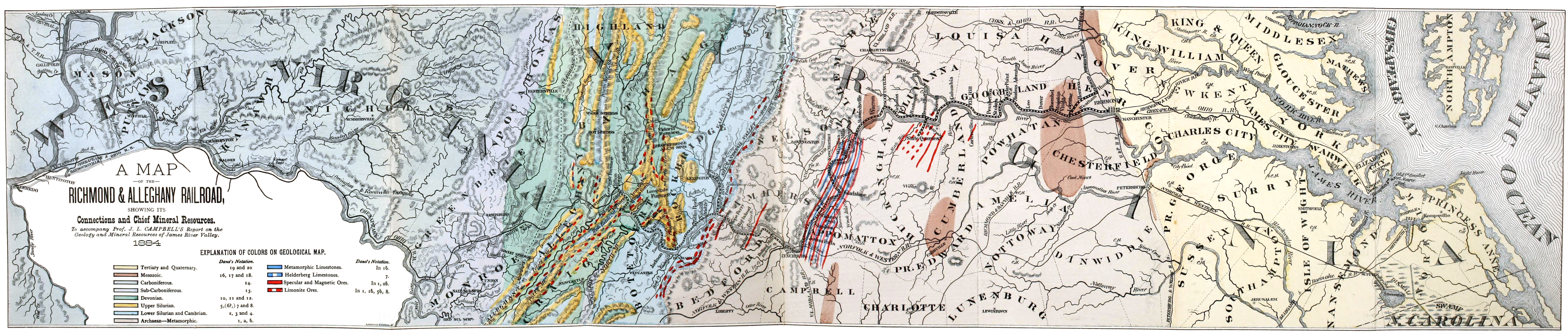
| Description | 1884 Map of the Richmond and Alleghany Railroad overlaid on a geological map of its route and connecting routes. The railroad operated from 1880 to 1888. | ||
| Date | |||
| Source | Found in back pocket of "Geology and mineral resources of the James River Valley (1882), scan available at the Internet Archive | ||
| Author | A. Hoen & Co. Richmond, Virginia (signed lower right hand corner of legend) | ||
| Permission (Reusing this file) |
|
File history
Click on a date/time to view the file as it appeared at that time.
| Date/Time | Thumbnail | Dimensions | User | Comment | |
|---|---|---|---|---|---|
| current | 02:41, 12 March 2014 | 7,433 × 1,585 (5.3 MB) | Morgan Riley | {{Information |Description =1884 Map of the Richmond and Alleghany Railroad overlaid on a geological map of its route and connecting routes. The railroad operated from 1880 to 1888. |Source =Found in back pocket of "Geology and mineral resou... |
File usage
The following pages on the English Wikipedia use this file (pages on other projects are not listed):