
File:RetrieveUnitBrazoriaAirport.PNG
No higher resolution available.
RetrieveUnitBrazoriaAirport.PNG (628 × 562 pixels, file size: 506 KB, MIME type: image/png)
| This is a file from the Wikimedia Commons. Information from its description page there is shown below. Commons is a freely licensed media file repository. You can help. |
Summary
| Description |
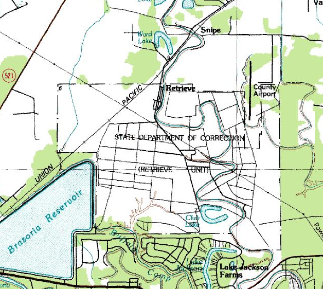
English: A topographic map of the Retrieve Unit (Wayne Scott Unit) and the Texas Gulf Coast Regional Airport (Brazoria County Airport) in Texas
Español: Mapa topográfico de la Unidad Retrieve (Unidad Wayne Scott) y el Aeropuerto Texas Gulf Coast (Aeropuerto del Condado de Brazoria) |
| Date | |
| Source |
USGS The National Map, via MSR Maps (formerly TerraServer-USA) |
| Author |
English: U.S. Geological Survey Español: Servicio Geológico de los Estados Unidos |
| Permission (Reusing this file) |
Public domain |
Licensing
This image is in the public domain in the United States because it only contains materials that originally came from the United States Geological Survey, an agency of the United States Department of the Interior. For more information, see the official USGS copyright policy.
|
File history
Click on a date/time to view the file as it appeared at that time.
| Date/Time | Thumbnail | Dimensions | User | Comment | |
|---|---|---|---|---|---|
| current | 22:03, 22 August 2010 | | 628 × 562 (506 KB) | WhisperToMe | {{Information |Description={{en|1=A topographic map of the Retrieve Unit (Wayne Scott Unit) and Brazoria County Airport}} {{es|1=Mapa topográfico de la Unidad Retrieve (Unidad Wayne Scott) y el [[: |
File usage
The following pages on the English Wikipedia use this file (pages on other projects are not listed):