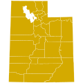
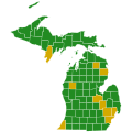
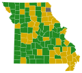
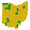
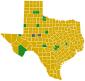
File:Republican Party presidential primaries results by county, 2016.svg

Size of this PNG preview of this SVG file: 800 × 507 pixels. Other resolutions: 320 × 203 pixels | 640 × 406 pixels | 1,024 × 649 pixels | 1,280 × 812 pixels | 2,560 × 1,623 pixels | 1,306 × 828 pixels.
Original file (SVG file, nominally 1,306 × 828 pixels, file size: 1.44 MB)
File history
Click on a date/time to view the file as it appeared at that time.
| Date/Time | Thumbnail | Dimensions | User | Comment | |
|---|---|---|---|---|---|
| current | 02:12, 23 February 2017 |  | 1,306 × 828 (1.44 MB) | WikiBunny2K1 | Added North Dakota at-large and the results of the Colorado conventions |
| 19:54, 18 February 2017 |  | 1,306 × 828 (1.44 MB) | WikiBunny2K1 | Updated shapes | |
| 04:52, 18 February 2017 |  | 1,304 × 828 (1.48 MB) | WikiBunny2K1 | Expanded image boundaries | |
| 03:57, 15 February 2017 |  | 1,304 × 827 (1.5 MB) | WikiBunny2K1 | Updated shape of Guam | |
| 17:46, 8 January 2017 |  | 1,304 × 827 (1.5 MB) | WikiBunny2K1 | Removed extra shapes | |
| 18:41, 2 January 2017 |  | 1,304 × 827 (1.55 MB) | WikiBunny2K1 | Updated | |
| 02:50, 19 December 2016 |  | 1,304 × 827 (1.74 MB) | WikiBunny2K1 | Fixed Wyoming and rotated Alaska | |
| 02:27, 7 December 2016 |  | 1,304 × 827 (1.74 MB) | WikiBunny2K1 | Fix Alaska | |
| 13:04, 8 June 2016 |  | 1,304 × 827 (1.74 MB) | LordHello1 | added june 7 results | |
| 23:15, 26 May 2016 |  | 1,304 × 827 (1.34 MB) | Kingofthedead | Per discussion page, 1 county in Maine for Trump instead of Cruz |
File usage
The following pages on the English Wikipedia use this file (pages on other projects are not listed):
Global file usage
The following other wikis use this file:
- Usage on da.wikipedia.org
- Usage on de.wikipedia.org
- Usage on es.wikipedia.org
- Usage on it.wikipedia.org
- Usage on no.wikipedia.org
- Usage on pt.wikipedia.org
- Usage on ru.wikipedia.org
- Usage on simple.wikipedia.org
- Usage on sk.wikipedia.org
- Usage on tr.wikipedia.org
- Usage on uk.wikipedia.org


