
File:Relief map of Crimea (disputed status).jpg

Size of this preview: 800 × 542 pixels. Other resolutions: 320 × 217 pixels | 640 × 434 pixels | 1,024 × 694 pixels | 1,200 × 813 pixels.
Original file (1,200 × 813 pixels, file size: 424 KB, MIME type: image/jpeg)
| This is a file from the Wikimedia Commons. Information from its description page there is shown below. Commons is a freely licensed media file repository. You can help. |
.jpg)
Summary
| Description |
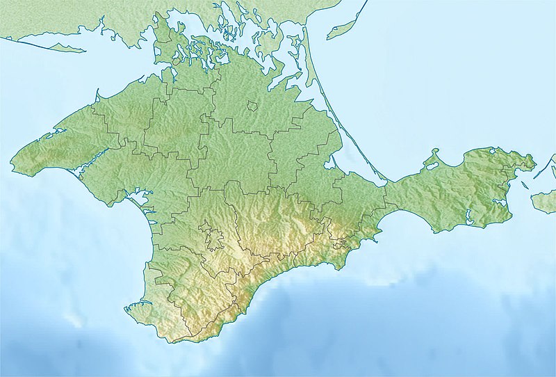
Русский: Физическая карта Крыма
Равноугольная проекция, стандартная параллель — 45°15′с.ш. Параметры шаблона (координаты краёв): English: Physical map of the Crimea
Conformal projection, standard parallels — 45°15's.W. Template parameters (coordinates of the edges):
|
| Date | |
| Source | Relief map of Crimea.jpg |
| Author | original map (see authors of Relief map of Crimea.jpg), derivative work: Dinamik |
Licensing
I, the copyright holder of this work, hereby publish it under the following license:
| I, the copyright holder of this work, release this work into the public domain. This applies worldwide. In some countries this may not be legally possible; if so: I grant anyone the right to use this work for any purpose, without any conditions, unless such conditions are required by law. |
File history
Click on a date/time to view the file as it appeared at that time.
| Date/Time | Thumbnail | Dimensions | User | Comment | |
|---|---|---|---|---|---|
| current | 21:43, 18 May 2018 | | 1,200 × 813 (424 KB) | Janitoalevic | Better quality |
| 11:42, 12 May 2014 |  | 1,200 × 813 (234 KB) | Dinamik | == {{int:filedesc}} == {{Information |Description = {{ru|1=Физическая карта Крыма<br>Равноугольная проекция, стандартная параллель — 45°15′с.ш.<br>Параметры шаблона (к... |
File usage
The following pages on the English Wikipedia use this file (pages on other projects are not listed):
- 1927 Crimean earthquakes
- Ai-Petri
- Alushta
- Aqtas Lake
- Arabat Fortress
- Arabat Spit
- Baherove (air base)
- Bakhchysarai Cave Monastery
- Baydar Nature Reserve
- Canğul
- Cape Aya
- Cape Fiolent
- Cape Fonar
- Charming Harbor National Nature Park
- Chonhar
- Chonhar Peninsula
- Chonhar Strait
- Chornomorske
- Chufut-Kale
- Chushka Spit
- Crimea
- Crimean Mountain karst
- Crimean Nature Reserve
- Demir-Kapu
- Demirci yayla
- Dhzurla
- Djur-Djur
- Donuzlav
- Feodosia Gulf
- Grand Canyon (Crimea)
- Gulf of Yalta
- Henicheska Hirka
- Heracles Peninsula
- Holovkinskoho waterfall
- Inkerman
- Inkerman Cave Monastery
- Kachyk lake
- Kalamita Bay
- Kara Dag Mountain
- Karadag Nature Reserve
- Karkinit Bay
- Karkinitska and Dzharylgatska Bays
- Karpivka, Crimea
- Kazantyp Nature Reserve
- Kerch (fortress)
- Kerch Airport
- Kerch Bay
- Kerch Peninsula
- Kerch Strait
- Koyashskoye Salt Lake
- Krasnoperekopsk
- Lavanda, Crimea
- Lithuanian Peninsula
- Maiak, Chornomorske Raion
- Mangup
- Mehmed III Giray
- Novofedorivka
- Novosilske, Crimea
- Nymphaion (Crimea)
- Olenivka, Chornomorske Raion
- Opuk (mountain)
- Opuk Nature Reserve
- Pantikapaion
- Partenit
- Perchem
- Perekop
- Qarabiy yayla
- Roman-Kosh
- Russo-Turkish War (1735–1739)
- Saky
- Saky (air base)
- Scythian Neapolis
- Sevastopol International Airport
- Shchaslyvtseve
- Simferopol International Airport
- Staryi Krym
- Strilkove
- Sudak
- Sudak Bay
- Swan Islands Nature Reserve
- Syvash
- Syvash, Kherson Oblast
- Tarkhankut Peninsula
- Tobechytske Lake
- Tuzla Spit
- Uchan-su (waterfall)
- Uzunlarske Lake
- Yalta Mountain-Forest Nature Reserve
- Yevpatoria
- Yevpatoria Bay
- Yevpatoria RT-70 radio telescope
- Yuke-Tepe
- Zeytin-Kosh
- User:Benjamin Trovato/sandbox
- User:Mercussek/sandbox
- User:Twas Now/Siege of Caffa
- User:Ty654/List of earthquakes from 1920-1929 exceeding magnitude 6+
- Module:Location map/data/Crimea
- Module:Location map/data/Crimea/doc
- Module:Location map/data/Ukraine Crimea
Global file usage
The following other wikis use this file:
- Usage on ast.wikipedia.org
- Usage on azb.wikipedia.org
- Usage on az.wikipedia.org
- Usage on ba.wikipedia.org
- Usage on bn.wikipedia.org
- Usage on bs.wikipedia.org
- Usage on ca.wikipedia.org
- Usage on ceb.wikipedia.org
- Usage on da.wikipedia.org
- Usage on el.wikipedia.org
- Usage on es.wikipedia.org
- Estrecho de Kerch
- Quersoneso (ciudad)
- Istmo de Perekop
- Neápolis escita
- Ai-Petri
- Río Almá (Crimea)
- Río Chorna (Crimea)
- Península de Kerch
- Bahía de Karkinit
- Bahía de Arabat
- Cabo Kazantip
- Isla Tuzla
- Cascada de Uchan-su
- Puerto Krym
- Kara Dag
- Plantilla:Mapa de localización de Crimea
- Faro Yenikalski
- Cueva de Mármol (Crimea)
- Cueva Viálova
- Monte Koshka
- Valle de Baydar
- Península de Heracles
- Faro de Tarjankut
- Puente de Crimea
- Crimea
- Declaración de Independencia de Crimea y Sebastopol
- Bahía de Feodosia
- Bahía de Sudak
- Bahía de Kalamita
- Bahía de Kerch
- Bahía de Yalta
- Bahía de Eupatoria
View more global usage of this file.
.jpg)
.jpg)