
File:Relief Map of Uzbekistan.png

Size of this preview: 800 × 529 pixels. Other resolutions: 320 × 211 pixels | 640 × 423 pixels | 1,024 × 677 pixels | 1,200 × 793 pixels.
Original file (1,200 × 793 pixels, file size: 1.42 MB, MIME type: image/png)
| This is a file from the Wikimedia Commons. Information from its description page there is shown below. Commons is a freely licensed media file repository. You can help. |
Summary
| Description |
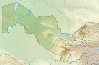
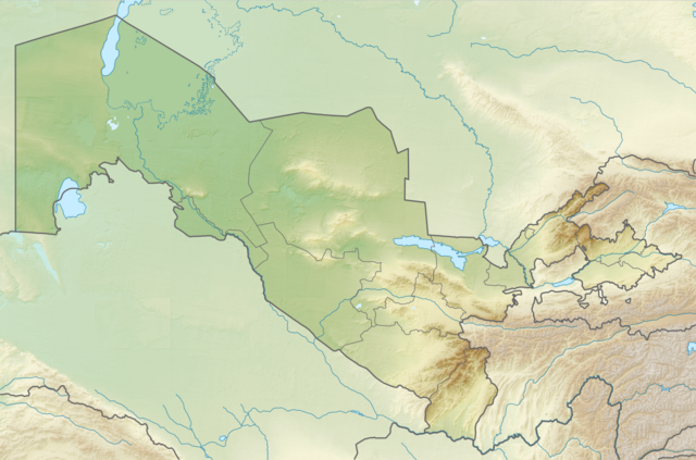
English: Relief map of Uzbekistan
Equirectangular projection, N/S stretching 130 %. Geographic limits of the map:
|
| Date | |
| Source | |
| Author |
|
| Permission (Reusing this file) |
This file is licensed under the Creative Commons Attribution-Share Alike 3.0 Unported license.
|
File history
Click on a date/time to view the file as it appeared at that time.
| Date/Time | Thumbnail | Dimensions | User | Comment | |
|---|---|---|---|---|---|
| current | 20:01, 26 August 2010 | | 1,200 × 793 (1.42 MB) | Виктор В | =={{int:filedesc}}== {{Information |Description={{en|Relief map of Uzbekistan}} Equirectangular projection, N/S stretching 130 %. Geographic limits of the map: * N: 45.9° N * S: 36.8° N * W: 55.6° E * E: 73.5° E |Source=*[[:File:Uzb |
File usage
The following pages on the English Wikipedia use this file (pages on other projects are not listed):
- 1902 Andijan earthquake
- 1946 Chatkal earthquake
- 1966 Tashkent earthquake
- 2011 Fergana Valley earthquake
- Afrasiab Museum of Samarkand
- Afrasiyab (Samarkand)
- Akchakhan-Kala
- Alpomish
- Andijan
- Andijan Dam
- Andizhan Airport
- Ayaz-Kala
- Aydar Lake
- Badai Tugai Nature Reserve
- Balalyk Tepe
- Banakat
- Battle of the Defile
- Beruniy
- Bibi-Khanym Mosque
- Bissekty Formation
- Boybuloq
- Bukhara
- Bukhara International Airport
- Central Asia
- Chatkal Range
- Chilek silver bowl
- Dalverzin Tepe
- Dark Star (cave)
- Denov
- Djarkutan
- Fann Mountains
- Fayaz Tepe
- Fergana
- Fergana International Airport
- Guldursun-Kala
- Isfayramsay
- Itchan Kala
- Kafir-kala (Uzbekistan)
- Kamchik Pass
- Kampir Tepe
- Kara Tepe
- Khalchayan
- Khazret Sultan
- Khiva
- Khodzhakul Formation
- Khonakhan Mosque
- Koi Krylgan Kala
- Kokand
- Koktepe
- Kugitang Svita
- Kurek Formation
- Kyzyl-Kala
- Kyzylkum Desert
- Lake Charvak
- Mavlonbuva Mausoleum
- Mount Adelung
- Mount Beshtor
- Muynak Airport
- Nukus
- Nukus Airport
- Nuratau Mountains
- Obi-Rakhmat Grotto
- Orlat plaques
- Pskem Mountains
- Qońirat
- Quva
- Samarkand
- Sarygamysh Lake
- Shahrisabz
- Shohimardon
- Shohimardonsoy
- Siege of Bukhara
- Siege of Samarkand (1220)
- Sokh snakes
- State Museum of History of Culture of Uzbekistan
- Suffa RT-70 radio telescope
- Tashkent
- Tavka Kurgan
- Termez
- Toprak-Kala
- Tuyabuguz Reservoir
- Tuyamuyun Hydro Complex
- Ugam-Chatkal National Park
- Ungar-Too
- Varakhsha
- Vardanzi
- Zaamin National Park
- Zarafshan Airport
- Zarafshon (river)
- User:Benjamin Trovato/sandbox
- User:Ty654/List of earthquakes from 1930-1939 exceeding magnitude 6+
- User:Ty654/List of earthquakes from 1940-1949 exceeding magnitude 6+
- User:Ty654/List of earthquakes from 1950-1999 exceeding magnitude 7+
- User:Ty654/List of earthquakes from 1955-1959 exceeding magnitude 6+
- User:Ty654/List of earthquakes from 1975-1979 exceeding magnitude 6+
- Module:Location map/data/Uzbekistan
- Module:Location map/data/Uzbekistan/doc
Global file usage
The following other wikis use this file:
- Usage on als.wikipedia.org
- Usage on ar.wikipedia.org
- Usage on ast.wikipedia.org
- Usage on av.wikipedia.org
- Usage on azb.wikipedia.org
- Usage on az.wikipedia.org
- Usage on ba.wikipedia.org
- Usage on bcl.wikipedia.org
- Usage on be.wikipedia.org
- Usage on bg.wikipedia.org
View more global usage of this file.