
File:Rega-hydrografia3.png
Size of this preview: 428 × 600 pixels. Other resolutions: 171 × 240 pixels | 342 × 480 pixels | 753 × 1,055 pixels.
Original file (753 × 1,055 pixels, file size: 450 KB, MIME type: image/png)
| This is a file from the Wikimedia Commons. Information from its description page there is shown below. Commons is a freely licensed media file repository. You can help. |
Summary
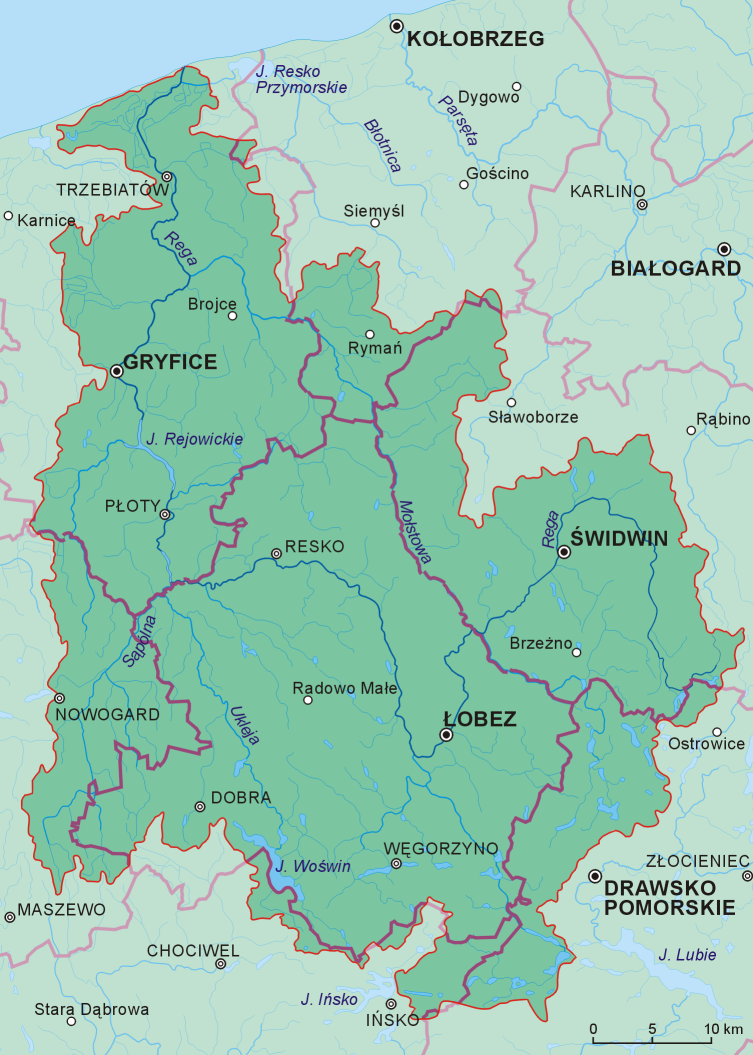
| Description |
Polski: Dorzecze Regi z podziałem administracyjnym (powiaty) oraz miastami powiatowymi, pozostałymi miastami i wsiami gminnymi |
| Date | |
| Source | Own workna podstawie map przeglądowych oraz mapy hydrograficznej Polski |
| Author | Aotearoa |
| Other versions |
|


Licensing
I, the copyright holder of this work, hereby publish it under the following license:
This file is licensed under the Creative Commons Attribution 3.0 Unported license.
- You are free:
- to share – to copy, distribute and transmit the work
- to remix – to adapt the work
- Under the following conditions:
- attribution – You must give appropriate credit, provide a link to the license, and indicate if changes were made. You may do so in any reasonable manner, but not in any way that suggests the licensor endorses you or your use.
File history
Click on a date/time to view the file as it appeared at that time.
| Date/Time | Thumbnail | Dimensions | User | Comment | |
|---|---|---|---|---|---|
| current | 15:15, 23 November 2009 | | 753 × 1,055 (450 KB) | Aotearoa | == {{int:filedesc}} == {{Information |Description= {{pl|1=Dorzecze Regi z podziałem administracyjnym (powiaty) oraz miastami powiatowymi, pozostałymi miastami i wsiami gminnymi}} |Source={{own}}na podstawie map przeglądowych oraz mapy hydrograficznej P |
File usage
The following pages on the English Wikipedia use this file (pages on other projects are not listed):
Global file usage
The following other wikis use this file:
- Usage on an.wikipedia.org
- Usage on ceb.wikipedia.org
- Usage on cs.wikipedia.org
- Usage on de.wikipedia.org
- Usage on fy.wikipedia.org
- Usage on hr.wikipedia.org
- Usage on ja.wikipedia.org
- Usage on ka.wikipedia.org
- Usage on lt.wikipedia.org
- Usage on nl.wikipedia.org
- Usage on pl.wikipedia.org
- Usage on sr.wikipedia.org
- Usage on sv.wikipedia.org
- Usage on www.wikidata.org