
File:Rakahanga.jpg
Size of this preview: 509 × 600 pixels. Other resolutions: 204 × 240 pixels | 634 × 747 pixels.
Original file (634 × 747 pixels, file size: 131 KB, MIME type: image/jpeg)
| This is a file from the Wikimedia Commons. Information from its description page there is shown below. Commons is a freely licensed media file repository. You can help. |
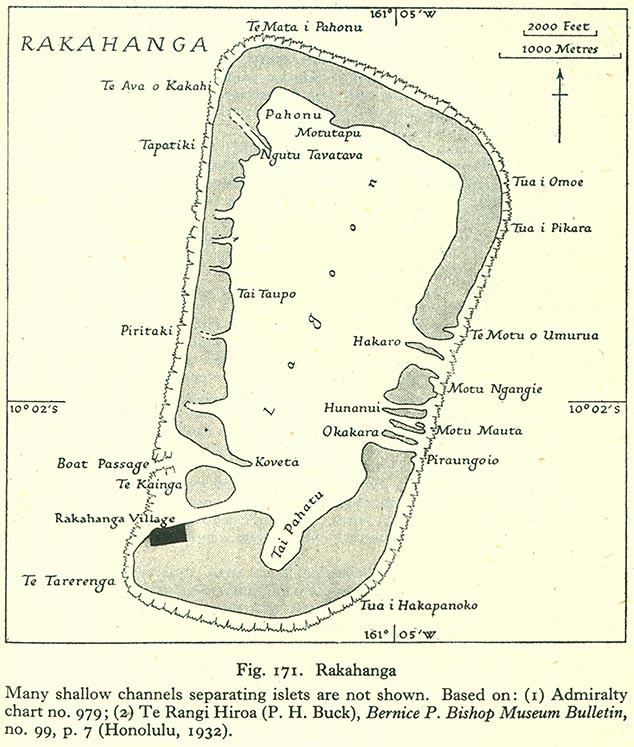
Summary
| Description |
English: Map of Rakahanga Atoll, Northern Cook Islands |
| Date | |
| Source | http://www.lib.utexas.edu/maps/historical/pacific_islands_1943_1945/rakahanga.jpg |
| Author | US Army |
Licensing
This file is in the public domain because it has been taken from a collection of public domain maps at the University of Texas Library
|
File history
Click on a date/time to view the file as it appeared at that time.
| Date/Time | Thumbnail | Dimensions | User | Comment | |
|---|---|---|---|---|---|
| current | 17:19, 10 August 2008 | | 634 × 747 (131 KB) | Ratzer | {{Information |Description={{en|1=Map of Rakahanga Atoll, Northern Cook Islands}} |Source=http://www.lib.utexas.edu/maps/historical/pacific_islands_1943_1945/rakahanga.jpg |Author=US Army |Date=1943 |Permission= |other_versions= }} {{ImageUpload|full}} |
File usage
The following pages on the English Wikipedia use this file (pages on other projects are not listed):
Global file usage
The following other wikis use this file:
- Usage on bcl.wikipedia.org
- Usage on ca.wikipedia.org
- Usage on ceb.wikipedia.org
- Usage on cs.wikipedia.org
- Usage on de.wikipedia.org
- Usage on es.wikipedia.org
- Usage on fr.wikipedia.org
- Usage on id.wikipedia.org
- Usage on is.wikipedia.org
- Usage on it.wikipedia.org
- Usage on ka.wikipedia.org
- Usage on la.wikipedia.org
- Usage on lt.wikipedia.org
- Usage on mt.wikipedia.org
- Usage on ru.wikipedia.org
- Usage on simple.wikipedia.org
- Usage on su.wikipedia.org
- Usage on sv.wikipedia.org
- Usage on tr.wikipedia.org
- Usage on www.wikidata.org