
File:Rade de Brest.svg

Size of this PNG preview of this SVG file: 800 × 527 pixels. Other resolutions: 320 × 211 pixels | 640 × 421 pixels | 1,024 × 674 pixels | 1,280 × 843 pixels | 2,560 × 1,686 pixels | 1,335 × 879 pixels.
Original file (SVG file, nominally 1,335 × 879 pixels, file size: 227 KB)
| This is a file from the Wikimedia Commons. Information from its description page there is shown below. Commons is a freely licensed media file repository. You can help. |
Summary
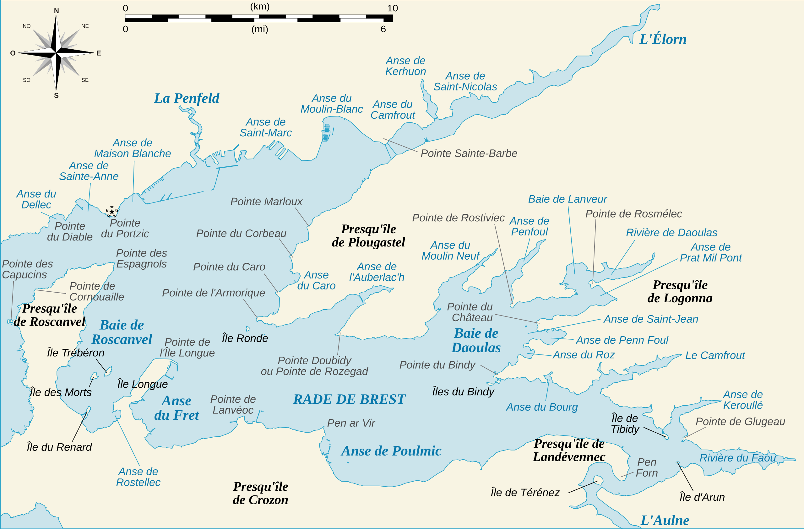
| Description | Plan de la rade de Brest (29-Finistère, France) |
| Date | |
| Source | Travail personnel d'après documents IGN |
| Author | L. Claudel (user:Sardon) |
| Other versions |
|


Licensing
| I, the copyright holder of this work, release this work into the public domain. This applies worldwide. In some countries this may not be legally possible; if so: I grant anyone the right to use this work for any purpose, without any conditions, unless such conditions are required by law. |
File history
Click on a date/time to view the file as it appeared at that time.
| Date/Time | Thumbnail | Dimensions | User | Comment | |
|---|---|---|---|---|---|
| current | 18:12, 27 August 2008 | | 1,335 × 879 (227 KB) | Sardon | {{Information |Description= |Source= |Date= |Author= |Permission= |other_versions= }} |
| 11:25, 27 August 2008 |  | 1,335 × 879 (257 KB) | Sardon | {{Information |Description= |Source= |Date= |Author= |Permission= |other_versions= }} | |
| 19:20, 26 August 2008 |  | 1,335 × 879 (411 KB) | Sardon | {{Information |Description=Plan de la rade de Brest (29-Finistère, France) |Source=Travail personnel d'après documents IGN |Date=26 août 2008 |Author=L. Claudel (user:Sardon) |Permission= |other_versions=image:Rade de Brest.png }} [[Category: |
File usage
The following pages on the English Wikipedia use this file (pages on other projects are not listed):
Global file usage
The following other wikis use this file:
- Usage on de.wikipedia.org
- Usage on eo.wikipedia.org
- Usage on es.wikipedia.org
- Usage on fr.wikipedia.org
- Usage on it.wikipedia.org
- Usage on ja.wikipedia.org
- Usage on zh.wikipedia.org