
File:Région métropolitaine de Montréal-blank.svg

Size of this PNG preview of this SVG file: 661 × 599 pixels. Other resolutions: 265 × 240 pixels | 530 × 480 pixels | 847 × 768 pixels | 1,130 × 1,024 pixels | 2,259 × 2,048 pixels | 1,667 × 1,511 pixels.
Original file (SVG file, nominally 1,667 × 1,511 pixels, file size: 302 KB)
| This is a file from the Wikimedia Commons. Information from its description page there is shown below. Commons is a freely licensed media file repository. You can help. |
Summary
| Description |
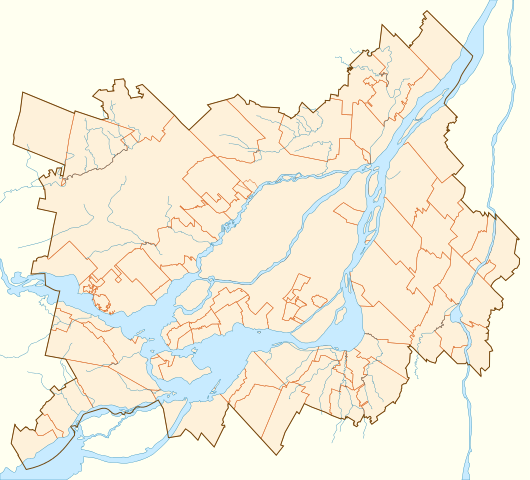
Français : Carte vierge de la région métropolitaine de Montréal, affichant son contour, le découpage des municipalités qui la composent, et ses principaux cours d'eau.
Projection conique conforme de Lambert |
||
| Date | |||
| Source | D'après la carte Secteur de recensement selon RMR / AR de Montréal (lien), 12 décembre 2011. | ||
| Author | Flappiefh | ||
| Other versions | |||
| SVG | W3C-validity not checked.
|
||
| Graphic Lab |

Licensing
I, the copyright holder of this work, hereby publish it under the following license:
This file is licensed under the Creative Commons Attribution-Share Alike 3.0 Unported license.
- You are free:
- to share – to copy, distribute and transmit the work
- to remix – to adapt the work
- Under the following conditions:
- attribution – You must give appropriate credit, provide a link to the license, and indicate if changes were made. You may do so in any reasonable manner, but not in any way that suggests the licensor endorses you or your use.
- share alike – If you remix, transform, or build upon the material, you must distribute your contributions under the same or compatible license as the original.
File history
Click on a date/time to view the file as it appeared at that time.
| Date/Time | Thumbnail | Dimensions | User | Comment | |
|---|---|---|---|---|---|
| current | 12:28, 22 May 2014 | | 1,667 × 1,511 (302 KB) | Sémhur | Valid SVG |
| 20:42, 3 September 2013 |  | 1,667 × 1,511 (302 KB) | Sémhur | Eau en bleu #C8EBFF | |
| 22:03, 28 July 2012 |  | 1,667 × 1,511 (328 KB) | Flappiefh | La carte précédente était inclinée de 3,8° par rapport au nord. Corrigé. | |
| 16:44, 27 July 2012 |  | 1,694 × 1,416 (346 KB) | Flappiefh | Rotation de 3.8° (le Nord est désormais aligné avec les bords de la carte). Correction des cours d'eau. | |
| 08:13, 21 July 2012 |  | 1,714 × 1,526 (331 KB) | Flappiefh | Ajustement des cours d'eau et des bords du Saint-Laurent. | |
| 07:49, 21 July 2012 |  | 1,714 × 1,526 (330 KB) | Flappiefh |
File usage
The following pages on the English Wikipedia use this file (pages on other projects are not listed):
- 2007 Presidents Cup
- 2015 Première ligue de soccer du Québec season
- Boisé du Tremblay
- Clock Tower Beach
- Cosmodome
- Country Club of Montreal
- Hôpital Charles-LeMoyne
- Hôpital Pierre Boucher
- Kanesatake
- Laflèche, Quebec
- Le Moyne, Quebec
- Parc Michel-Chartrand
- Parc de la Cité
- Terrebonne, Quebec
- The Ring (Montreal)
- Module:Location map/data/Canada Greater Montreal
- Module:Location map/data/Canada Greater Montreal/doc
Global file usage
The following other wikis use this file:
- Usage on eo.wikipedia.org
- Mascouche (Kebekio)
- Internacia Aera Transporta Asocio
- Universitato McGill
- Festival International de Jazz de Montréal
- Fondumo por Esperantologiaj Studoj
- Juste pour rire
- Universitato Concordia
- Oratorio Sankta Jozefo
- Berri-UQAM (metroo de Montrealo)
- Snowdon (metroo de Montrealo)
- Jean-Talon (metroo de Montrealo)
- Ŝablono:Situo sur mapo Kanado Montrealo
- Lionel-Groulx (metroo de Montrealo)
- Angrignon (metroo de Montrealo)
- Honoré-Beaugrand (metroo de Montrealo)
- Côte-Vertu (metroo de Montrealo)
- Montmorency (metroo de Montrealo)
- Saint-Michel (metroo de Montrealo)
- Longueuil–Université-de-Sherbrooke (metroo de Montrealo)
- Jean-Drapeau (metroo de Montrealo)
- Guy-Concordia (metroo de Montrealo)
- McGill (metroo de Montrealo)
- Atwater (metroo de Montrealo)
- Frontenac (metroo de Montrealo)
- Pie-IX (metroo de Montrealo)
- Viau (metroo de Montrealo)
- Joliette (metroo de Montrealo)
- Place-Saint-Henri (metroo de Montrealo)
- Vendôme (metroo de Montrealo)
- Lucien-L'Allier (metroo de Montrealo)
- Bonaventure (metroo de Montrealo)
- Sauvé (metroo de Montrealo)
- De la Concorde (metroo de Montrealo)
- Parc (metroo de Montrealo)
- Côte-des-Neiges (metroo de Montrealo)
- Université-de-Montréal (metroo de Montrealo)
- Édouard-Montpetit (metroo de Montrealo)
- Outremont (metroo de Montrealo)
- Acadie (metroo de Montrealo)
- De Castelnau (metroo de Montrealo)
- Fabre (metroo de Montrealo)
- D'Iberville (metroo de Montrealo)
- Crémazie (metroo de Montrealo)
- Henri-Bourassa (metroo de Montrealo)
- Cartier (metroo de Montrealo)
- Monk (metroo de Montrealo)
- Jolicoeur (metroo de Montrealo)
- Verdun (metroo de Montrealo)
- De L'Église (metroo de Montrealo)
- Du Collège (metroo de Montrealo)
View more global usage of this file.