
File:Provinces of Spain.svg

Size of this PNG preview of this SVG file: 569 × 392 pixels. Other resolutions: 320 × 220 pixels | 640 × 441 pixels | 1,024 × 705 pixels | 1,280 × 882 pixels | 2,560 × 1,764 pixels.
Original file (SVG file, nominally 569 × 392 pixels, file size: 519 KB)
| This is a file from the Wikimedia Commons. Information from its description page there is shown below. Commons is a freely licensed media file repository. You can help. |

|
This file is a work by Javitomad. Please credit this: Javitomad personal gallery. |

|
Summary
| Description |
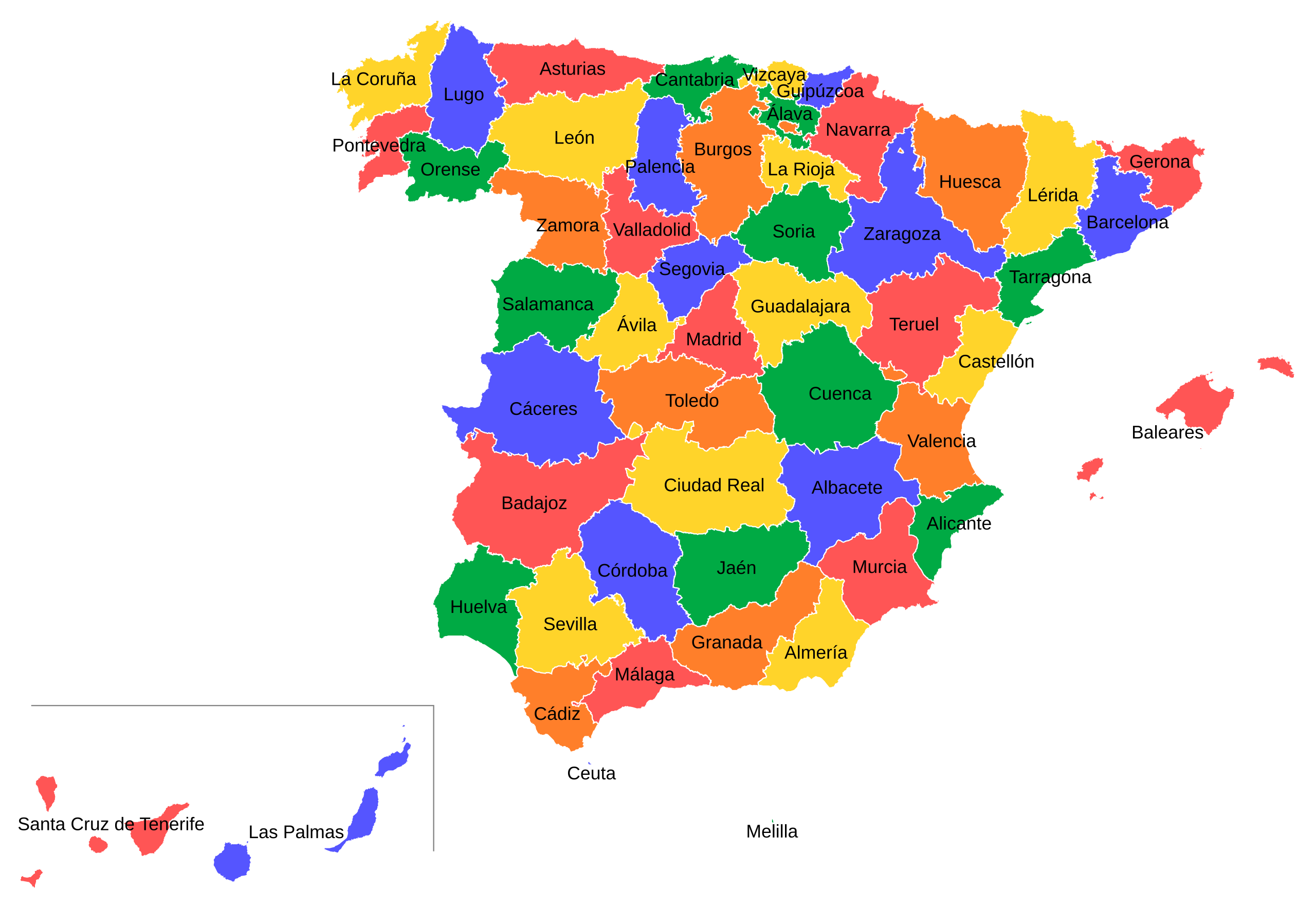
Español: Mapa provincial de España.
English: Provincial map of Spain.
Français : Carte des provinces de l'Espagne
Português: Mapa das províncias de Espanha. |
| Date |
Español: 31 de diciembre de 2010
(Primera versión, 2003) English: 31st december 2010
(First version, 2003) Français : 31 décembre 2010
(Première version, 2003) Italiano: 31 dicembre 2010
(Prima versione, 2003) Português: 31 de Dezembro de 2010 (Primeira versão, 2003) |
| Source |
Own work This W3C-unspecified vector image was created with Inkscape . |
| Author | Emilio Gómez Fernández & Javi C. S. |
| Other versions |
Derivative works of this file: |
Licensing
I, the copyright holder of this work, hereby publish it under the following licenses:

|
Permission is granted to copy, distribute and/or modify this document under the terms of the GNU Free Documentation License, Version 1.2 or any later version published by the Free Software Foundation; with no Invariant Sections, no Front-Cover Texts, and no Back-Cover Texts. A copy of the license is included in the section entitled GNU Free Documentation License. |
This file is licensed under the Creative Commons Attribution-Share Alike 4.0 International, 3.0 Unported, 2.5 Generic, 2.0 Generic and 1.0 Generic license.
- You are free:
- to share – to copy, distribute and transmit the work
- to remix – to adapt the work
- Under the following conditions:
- attribution – You must give appropriate credit, provide a link to the license, and indicate if changes were made. You may do so in any reasonable manner, but not in any way that suggests the licensor endorses you or your use.
- share alike – If you remix, transform, or build upon the material, you must distribute your contributions under the same or compatible license as the original.
You may select the license of your choice.
File history
Click on a date/time to view the file as it appeared at that time.
| Date/Time | Thumbnail | Dimensions | User | Comment | |
|---|---|---|---|---|---|
| current | 00:16, 15 November 2013 | | 569 × 392 (519 KB) | Ori~ | Reverted to version as of 18:27, 31 December 2010 |
| 00:10, 15 November 2013 |  | 569 × 392 (519 KB) | Ori~ | {{Information |Description=Provinces of Spain |Source={{own}} after File:Provinces of Spain.svg |Date=2013-11-15 |Author= Ori~ |Permission={{self|GFDL|cc-by-sa-all}} |other_versions= }} [[Category:Map... | |
| 18:27, 31 December 2010 |  | 569 × 392 (519 KB) | Javitomad | Change of colours. | |
| 17:19, 31 December 2010 |  | 569 × 392 (519 KB) | Javitomad | +Colours & -File size. | |
| 14:03, 29 October 2005 |  | 778 × 413 (1.46 MB) | Tony Rotondas | '''Title''' :'''es:''' Mapa provincial de España (España). 2003 :'''en:''' Provincial map of Spain (Spain) '''Author''' :[http://es.wikipedia.org/wiki/Usuario:Tony_Rotondas Emilio Gómez Fernández] {{GFDL}} Category:Maps of Spain |
File usage
The following pages on the English Wikipedia use this file (pages on other projects are not listed):
Global file usage
The following other wikis use this file:
- Usage on af.wikipedia.org
- Usage on ar.wikipedia.org
- Usage on be.wikipedia.org
- Usage on bg.wikipedia.org
- Usage on bs.wikipedia.org
- Usage on cs.wikipedia.org
- Usage on cy.wikipedia.org
- Usage on diq.wikipedia.org
- Usage on el.wikipedia.org
- Usage on en.wikibooks.org
- Usage on es.wikiquote.org
- Usage on eu.wikipedia.org
- Usage on fi.wikipedia.org
- Usage on frr.wikipedia.org
- Usage on fr.wikipedia.org
- Usage on ga.wikipedia.org
- Usage on hr.wikipedia.org
- Usage on hy.wikipedia.org
- Usage on ia.wikipedia.org
- Usage on id.wikipedia.org
- Usage on incubator.wikimedia.org
- Usage on is.wikipedia.org
- Usage on it.wikipedia.org
- Usage on ja.wikipedia.org
- Usage on kk.wikipedia.org
- Usage on lb.wikipedia.org
- Usage on lez.wikipedia.org
- Usage on lt.wikipedia.org
- Usage on nl.wikipedia.org
- Usage on nn.wikipedia.org
- Usage on no.wikipedia.org
- Usage on pam.wikipedia.org
- Usage on pl.wikipedia.org
- Usage on pt.wikipedia.org
- Usage on roa-tara.wikipedia.org
- Usage on ru.wikipedia.org
- Usage on ru.wikinews.org
View more global usage of this file.