
File:Provence in France (1789).svg

Size of this PNG preview of this SVG file: 624 × 600 pixels. Other resolutions: 250 × 240 pixels | 499 × 480 pixels | 799 × 768 pixels | 1,066 × 1,024 pixels | 2,131 × 2,048 pixels | 2,000 × 1,922 pixels.
Original file (SVG file, nominally 2,000 × 1,922 pixels, file size: 1.05 MB)
| This is a file from the Wikimedia Commons. Information from its description page there is shown below. Commons is a freely licensed media file repository. You can help. |
.svg)
Summary
| Description |
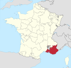
English: Map of XY (see filename) province in France (1789), extracted from File:France location map-Provinces 1789.svg |
| Date | |
| Source | Own work |
| Author | Milenioscuro |
Licensing
I, the copyright holder of this work, hereby publish it under the following license:
This file is licensed under the Creative Commons Attribution-Share Alike 4.0 International license.
- You are free:
- to share – to copy, distribute and transmit the work
- to remix – to adapt the work
- Under the following conditions:
- attribution – You must give appropriate credit, provide a link to the license, and indicate if changes were made. You may do so in any reasonable manner, but not in any way that suggests the licensor endorses you or your use.
- share alike – If you remix, transform, or build upon the material, you must distribute your contributions under the same or compatible license as the original.
File history
Click on a date/time to view the file as it appeared at that time.
| Date/Time | Thumbnail | Dimensions | User | Comment | |
|---|---|---|---|---|---|
| current | 17:08, 28 November 2019 | | 2,000 × 1,922 (1.05 MB) | Milenioscuro | improved |
| 21:33, 22 November 2019 |  | 588 × 550 (128 KB) | Milenioscuro | User created page with UploadWizard |
File usage
The following pages on the English Wikipedia use this file (pages on other projects are not listed):
Global file usage
The following other wikis use this file:
- Usage on an.wikipedia.org
- Usage on az.wikipedia.org
- Usage on be-tarask.wikipedia.org
- Usage on be.wikipedia.org
- Usage on ca.wikipedia.org
- Usage on csb.wikipedia.org
- Usage on cs.wikipedia.org
- Usage on cy.wikipedia.org
- Usage on da.wikipedia.org
- Usage on de.wikipedia.org
- Usage on es.wikipedia.org
- Usage on es.wiktionary.org
- Usage on fa.wikipedia.org
- Usage on fr.wikipedia.org
- Usage on he.wikipedia.org
- Usage on hu.wikipedia.org
- Usage on it.wikipedia.org
- Usage on ja.wikipedia.org
- Usage on kk.wikipedia.org
- Usage on ko.wikipedia.org
- Usage on ky.wikipedia.org
- Usage on lt.wikipedia.org
- Usage on nl.wikipedia.org
- Usage on pl.wikipedia.org
- Usage on pl.wiktionary.org
- Usage on ru.wikipedia.org
- Usage on sk.wikipedia.org
- Usage on sv.wikipedia.org
- Usage on ta.wikipedia.org
- Usage on tr.wikipedia.org
- Usage on uz.wikipedia.org
- Usage on vi.wikipedia.org
- Usage on zh.wikipedia.org
View more global usage of this file.
.svg)
.svg)