
File:Preston Brook tunnel - geograph.org.uk - 532964.jpg
No higher resolution available.
Preston_Brook_tunnel_-_geograph.org.uk_-_532964.jpg (640 × 477 pixels, file size: 94 KB, MIME type: image/jpeg)
| This is a file from the Wikimedia Commons. Information from its description page there is shown below. Commons is a freely licensed media file repository. You can help. |
Summary
| Description |
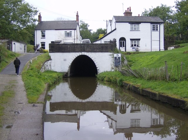
English: Preston Brook tunnel. Taken on a duller day than that by Johnny Essex. The tunnel (1237 yards long) is too narrow to allow two boats to pass. Therefore there is a time control, northbound boats (this direction) being allowed to enter between 00 and 10 past, southbound boats between 30 and 40. It takes about 15-20 minutes to travel through. We had arrive at quarter past so had to wait. |
| Date | |
| Source | From geograph.org.uk |
| Author | Graham Horn |
| Attribution (required by the license) | Graham Horn / Preston Brook tunnel / |
| Camera location | | View this and other nearby images on: OpenStreetMap |
|---|
_heading:337.00&language=en)
| Object location | | View this and other nearby images on: OpenStreetMap |
|---|
_heading:337.00&language=en)
Licensing

|
This image was taken from the Geograph project collection. See this photograph's page on the Geograph website for the photographer's contact details. The copyright on this image is owned by Graham Horn and is licensed for reuse under the Creative Commons Attribution-ShareAlike 2.0 license.
|
This file is licensed under the Creative Commons Attribution-Share Alike 2.0 Generic license.
Attribution: Graham Horn
- You are free:
- to share – to copy, distribute and transmit the work
- to remix – to adapt the work
- Under the following conditions:
- attribution – You must give appropriate credit, provide a link to the license, and indicate if changes were made. You may do so in any reasonable manner, but not in any way that suggests the licensor endorses you or your use.
- share alike – If you remix, transform, or build upon the material, you must distribute your contributions under the same or compatible license as the original.
File history
Click on a date/time to view the file as it appeared at that time.
| Date/Time | Thumbnail | Dimensions | User | Comment | |
|---|---|---|---|---|---|
| current | 20:45, 5 February 2011 | | 640 × 477 (94 KB) | GeographBot | == {{int:filedesc}} == {{Information |description={{en|1=Preston Brook tunnel Taken on a duller day than that by Johnny Essex. The tunnel (1237 yards long)is too narrow to allow two boats to pass. Therefore there is a time control, northbound boats (thi |
File usage
The following pages on the English Wikipedia use this file (pages on other projects are not listed):
Global file usage
The following other wikis use this file:
- Usage on ar.wikipedia.org
- Usage on fa.wikipedia.org