
File:Portugalete Las Arenas Vizcaya Bridge North 001.jpg

Size of this preview: 800 × 259 pixels. Other resolutions: 320 × 103 pixels | 640 × 207 pixels | 1,024 × 331 pixels | 1,280 × 414 pixels | 2,560 × 827 pixels | 8,145 × 2,632 pixels.
Original file (8,145 × 2,632 pixels, file size: 7.23 MB, MIME type: image/jpeg)
| This is a file from the Wikimedia Commons. Information from its description page there is shown below. Commons is a freely licensed media file repository. You can help. |
Summary
| Description |
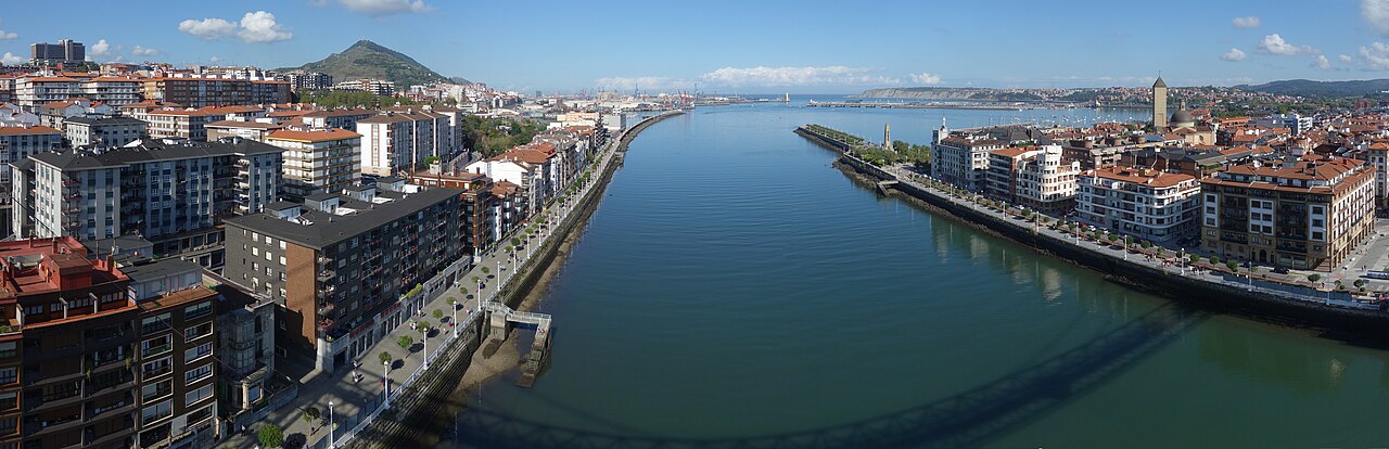
English: A view of Portugalete to the left, the Estuary of Bilbao, and Las Arenas to the right, as seen from the Puente Transbordador de Vizcaya, looking to the north. |
| Date | |
| Source | Own work |
| Author | User Spike |
| Other versions |
|

| Camera Model | Sony DSC-RX100 |
|---|---|
| Shutter speed | 1/2000 |
| Aperture | f/3.5 |
| Film speed (ISO) | 125 |
| Focal length | 10.5 mm |
| Focal length (35 mm equiv.) | 28.0 mm |
| Camera location | | View this and other nearby images on: OpenStreetMap |
|---|

|
NOTE: This image is a panorama of Portugalete, the estuary of Bilbao and Las Arenas consisting of 6 frames that were merged or stitched in Hugin. As a result, this image necessarily underwent some form of digital manipulation. These manipulations may include blending, blurring, cloning, and colour and perspective adjustments. As a result of these adjustments, the image content may be slightly different from reality at the points where multiple images were combined. This manipulation is often required due to lens, perspective, and parallax distortions.
|
| This is a retouched picture, which means that it has been digitally altered from its original version. Modifications: Some parts of the sky and of the river were missing or were obscured by the Vizcaya bridge. They have been replaced using the cloning tool in GIMP. The original can be viewed here: Portugalete Las Arenas Vizcaya Bridge North 002.jpg:
|
Licensing
I, the copyright holder of this work, hereby publish it under the following license:
This file is licensed under the Creative Commons Attribution-Share Alike 4.0 International license.
- You are free:
- to share – to copy, distribute and transmit the work
- to remix – to adapt the work
- Under the following conditions:
- attribution – You must give appropriate credit, provide a link to the license, and indicate if changes were made. You may do so in any reasonable manner, but not in any way that suggests the licensor endorses you or your use.
- share alike – If you remix, transform, or build upon the material, you must distribute your contributions under the same or compatible license as the original.
File history
Click on a date/time to view the file as it appeared at that time.
| Date/Time | Thumbnail | Dimensions | User | Comment | |
|---|---|---|---|---|---|
| current | 19:31, 11 October 2016 | 8,145 × 2,632 (7.23 MB) | Spike | The horizon is now more horizontal. | |
| 22:42, 4 October 2016 | 8,117 × 2,524 (7.07 MB) | Spike | User created page with UploadWizard |
File usage
The following pages on the English Wikipedia use this file (pages on other projects are not listed):
Global file usage
The following other wikis use this file:
- Usage on gl.wikipedia.org
- Usage on ml.wikipedia.org
- Usage on mt.wikipedia.org
- Usage on sr.wikipedia.org
- Usage on tr.wikipedia.org