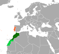
File:Portugal Morocco Locator.png

Size of this preview: 567 × 600 pixels. Other resolutions: 227 × 240 pixels | 454 × 480 pixels | 726 × 768 pixels | 1,036 × 1,096 pixels.
Original file (1,036 × 1,096 pixels, file size: 48 KB, MIME type: image/png)
File history
Click on a date/time to view the file as it appeared at that time.
| Date/Time | Thumbnail | Dimensions | User | Comment | |
|---|---|---|---|---|---|
| current | 05:57, 13 November 2021 |  | 1,036 × 1,096 (48 KB) | Aquintero82 | Updated map |
| 04:21, 11 March 2021 |  | 339 × 266 (9 KB) | Al.Massira | Reverted to version as of 21:42, 10 March 2021 (UTC) Per COM:OVERWRITE, restoring the original long standing version that was here for nine years longer | |
| 03:33, 11 March 2021 |  | 1,160 × 1,056 (80 KB) | Koavf | Reverted to version as of 21:41, 10 March 2021 (UTC) | |
| 21:42, 10 March 2021 |  | 339 × 266 (9 KB) | Al.Massira | Reverted to version as of 21:38, 10 March 2021 (UTC) Per COM:OVERWRITE I am restoring the original, longest standing version. Original file | |
| 21:41, 10 March 2021 |  | 1,160 × 1,056 (80 KB) | M.Bitton | Reverted to version as of 23:28, 29 December 2020 (UTC): Per COM:OVERWRITE | |
| 21:38, 10 March 2021 |  | 339 × 266 (9 KB) | Al.Massira | Reverted to version as of 16:24, 10 March 2021 (UTC) fair enough, going back to original file highlighting the Western Sahara region | |
| 21:31, 10 March 2021 |  | 1,160 × 1,056 (80 KB) | M.Bitton | Reverted to version as of 23:28, 29 December 2020 (UTC): Per COM:OVERWRITE | |
| 19:40, 10 March 2021 |  | 1,160 × 1,056 (46 KB) | Al.Massira | I made a version that seems more fair, going back to the newer map which is more detailed, a color switch is fine but highlighted the Western Sahara just like it was in the old/original version. I also put a dash border between them because the old version did not have a border between them, while the new version does, so a dashed line would be in the between. | |
| 16:24, 10 March 2021 |  | 339 × 266 (9 KB) | Al.Massira | Reverted to version as of 04:05, 19 August 2020 (UTC) original file and colors | |
| 23:28, 29 December 2020 |  | 1,160 × 1,056 (80 KB) | Aquintero82 | Updated map |
File usage
The following pages on the English Wikipedia use this file (pages on other projects are not listed):
Global file usage
The following other wikis use this file:
- Usage on ar.wikipedia.org
- Usage on de.wikipedia.org
- Usage on es.wikipedia.org
- Usage on fa.wikipedia.org
- Usage on he.wikipedia.org
- Usage on ru.wikipedia.org
- Usage on uk.wikipedia.org
- Usage on www.wikidata.org
- Usage on zh.wikipedia.org

