
File:Pont-canal des Herbettes et le périphérique.jpg

Size of this preview: 800 × 534 pixels. Other resolutions: 320 × 214 pixels | 640 × 427 pixels | 1,024 × 683 pixels | 1,280 × 854 pixels | 2,560 × 1,709 pixels | 7,360 × 4,912 pixels.
Original file (7,360 × 4,912 pixels, file size: 2.96 MB, MIME type: image/jpeg)
| This is a file from the Wikimedia Commons. Information from its description page there is shown below. Commons is a freely licensed media file repository. You can help. |
Summary
| Description |
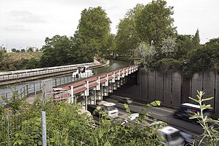
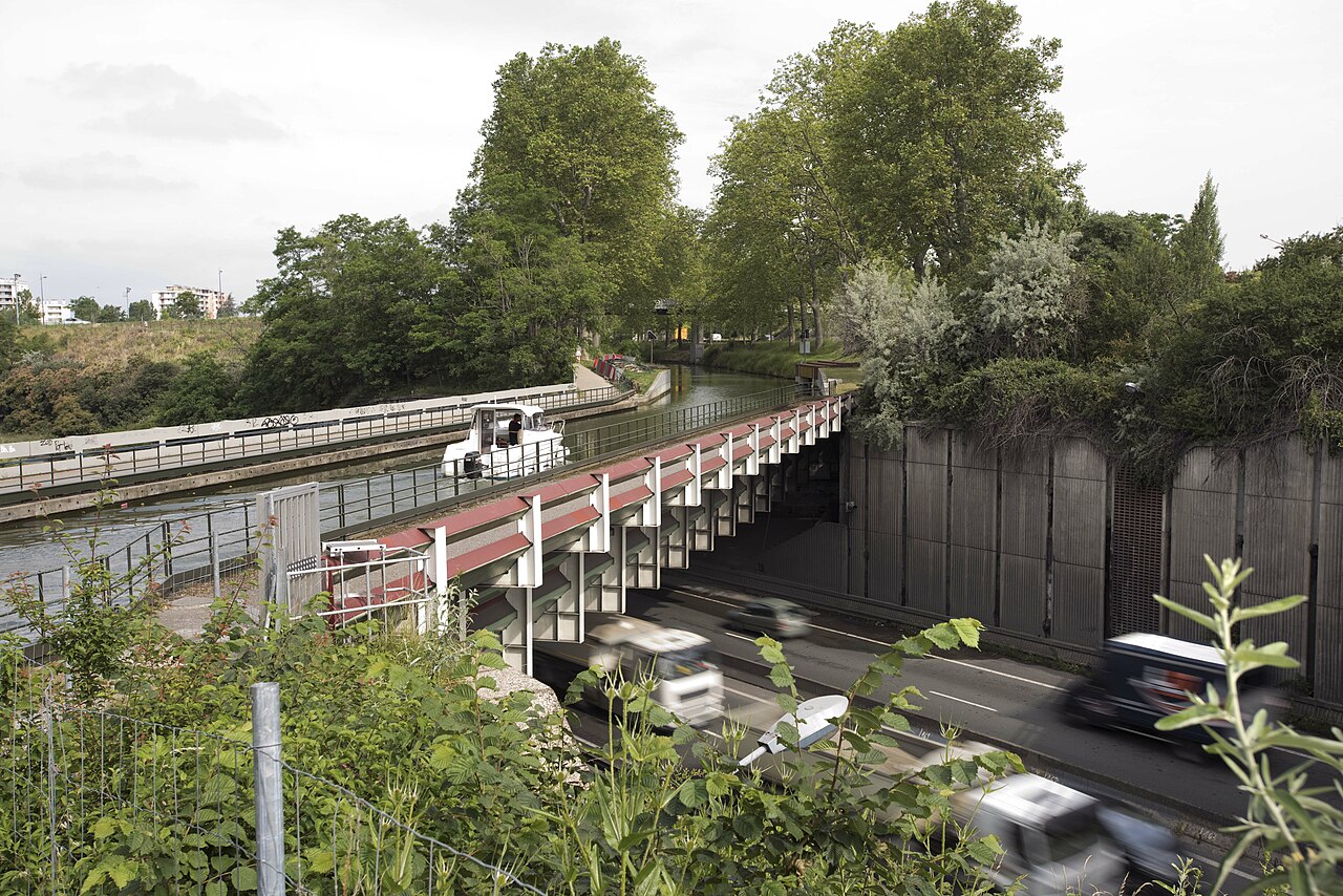
Français : Pont-canal en acier, construit au début des années 1980, en remplacement du lit en terre du canal. Il surplombe le périphérique sud, traversant le quartier de Rangueil en tranchée pour limiter les nuisances sonores.
Stéphanie Renard. Ville de Toulouse, Archives municipales.
English: Steel canal bridge, built in the early 1980s, replacing the earthen bed of the canal. It overlooks the southern Périphérique ring road, crossing the Rangueil district in a trench to limit noise pollution.
Stephanie Renard. City of Toulouse, Municipal Archives. |
| Date | |
| Source | https://www.flickr.com/photos/archives-toulouse/29162656834/ |
| Author | Stéphanie Renard. Ville de Toulouse, Archives municipales de Toulouse |
| Camera location | | View this and other nearby images on: OpenStreetMap |
|---|
Licensing
This file is licensed under the Creative Commons Attribution-Share Alike 2.0 Generic license.
- You are free:
- to share – to copy, distribute and transmit the work
- to remix – to adapt the work
- Under the following conditions:
- attribution – You must give appropriate credit, provide a link to the license, and indicate if changes were made. You may do so in any reasonable manner, but not in any way that suggests the licensor endorses you or your use.
- share alike – If you remix, transform, or build upon the material, you must distribute your contributions under the same or compatible license as the original.
| This image was originally posted to Flickr by AMToulouse at https://flickr.com/photos/115195291@N02/29162656834. It was reviewed on 12 April 2021 by FlickreviewR 2 and was confirmed to be licensed under the terms of the cc-by-sa-2.0. |
File history
Click on a date/time to view the file as it appeared at that time.
| Date/Time | Thumbnail | Dimensions | User | Comment | |
|---|---|---|---|---|---|
| current | 11:22, 12 April 2021 | | 7,360 × 4,912 (2.96 MB) | Luk | Uploaded a work by Archives municipales de Toulouse from https://www.flickr.com/photos/archives-toulouse/29162656834/ with UploadWizard |
File usage
The following pages on the English Wikipedia use this file (pages on other projects are not listed):
Global file usage
The following other wikis use this file:
- Usage on fr.wikipedia.org