
File:Ponce de leon inlet map.jpg
Size of this preview: 800 × 533 pixels. Other resolutions: 320 × 213 pixels | 640 × 427 pixels | 810 × 540 pixels.
Original file (810 × 540 pixels, file size: 72 KB, MIME type: image/jpeg)
| This is a file from the Wikimedia Commons. Information from its description page there is shown below. Commons is a freely licensed media file repository. You can help. |
Summary
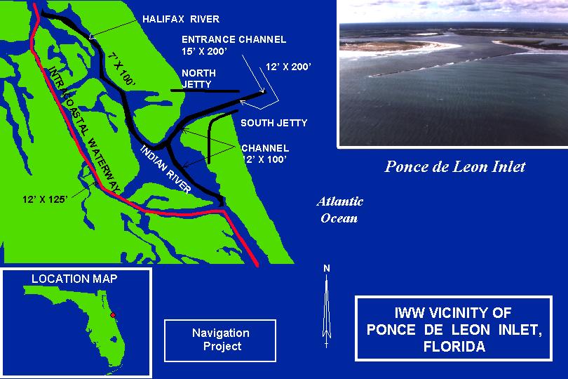
Found at http://www.saj.usace.army.mil/nav/ponce%20de%20leon%20inlet%20iww%20sec%201135%20fl%20map.jpg
Licensing
This image or file is a work of a U.S. Army Corps of Engineers soldier or employee, taken or made as part of that person's official duties. As a work of the U.S. federal government, the image is in the public domain.
|
File history
Click on a date/time to view the file as it appeared at that time.
| Date/Time | Thumbnail | Dimensions | User | Comment | |
|---|---|---|---|---|---|
| current | 12:03, 24 February 2007 | | 810 × 540 (72 KB) | Donald Albury | Found at http://www.saj.usace.army.mil/nav/ponce%20de%20leon%20inlet%20iww%20sec%201135%20fl%20map.jpg |
File usage
The following pages on the English Wikipedia use this file (pages on other projects are not listed):
Global file usage
The following other wikis use this file:
- Usage on www.wikidata.org