
File:Plan of Braich-y-Dinas.png
Size of this preview: 707 × 599 pixels. Other resolutions: 283 × 240 pixels | 566 × 480 pixels | 822 × 697 pixels.
Original file (822 × 697 pixels, file size: 591 KB, MIME type: image/png)
| This is a file from the Wikimedia Commons. Information from its description page there is shown below. Commons is a freely licensed media file repository. You can help. |
Summary
| Description |
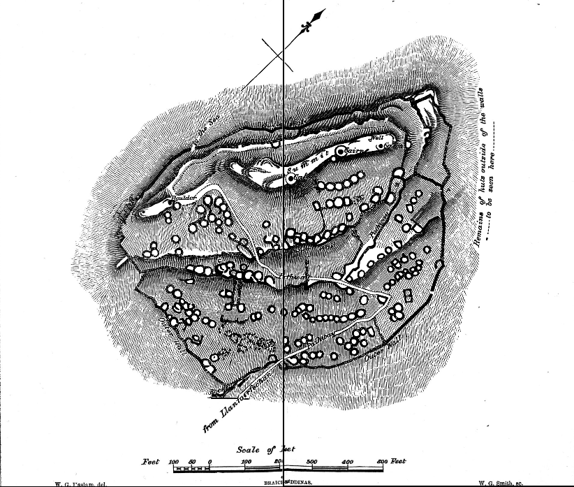
English: Detailed plan of Braich-y-Dinas, published in an 1877 edition of the antiquities journal 'Archaeologia Cambrensis' (Fourth Series No. XXXI July, 1877); made by W.G. Haslam and W.G. Smith. |
| Date | |
| Source | https://journals.library.wales/view/2919943/3001914/90 |
| Author | W.G. Haslam / W.G. Smith for Archaeologia Cambrensis |
| Camera location | | View this and other nearby images on: OpenStreetMap |
|---|
Licensing
This work is in the public domain in the United States because it was published (or registered with the U.S. Copyright Office) before January 1, 1929.
Public domain works must be out of copyright in both the United States and in the source country of the work in order to be hosted on the Commons. If the work is not a U.S. work, the file must have an additional copyright tag indicating the copyright status in the source country.
Note: This tag should not be used for sound recordings. |
File history
Click on a date/time to view the file as it appeared at that time.
| Date/Time | Thumbnail | Dimensions | User | Comment | |
|---|---|---|---|---|---|
| current | 13:18, 27 September 2017 | | 822 × 697 (591 KB) | Telenarn | User created page with UploadWizard |
File usage
The following pages on the English Wikipedia use this file (pages on other projects are not listed):
Global file usage
The following other wikis use this file:
- Usage on www.wikidata.org