
File:Pipers Stone - geograph.org.uk - 433278.jpg
No higher resolution available.
Pipers_Stone_-_geograph.org.uk_-_433278.jpg (640 × 480 pixels, file size: 108 KB, MIME type: image/jpeg)
| This is a file from the Wikimedia Commons. Information from its description page there is shown below. Commons is a freely licensed media file repository. You can help. |
Summary
| Description |
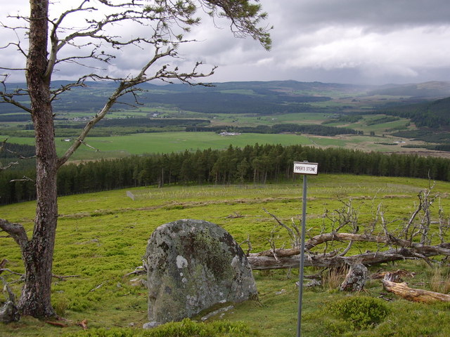
English: Pipers Stone We came across this stone on the way down from Coronation Cairn on the Cromdale Hills. According to history during the Battle of Haughs of Cromdale in 1689 a single piper Hamish, though badly wounded, managed to drag himself atop a sizeable boulder and continue to play song after song spurring on his men until he finally fell and died. The stone on which he played was later, appropriately named "The Pipers Stone". |
| Date | |
| Source | From geograph.org.uk |
| Author | Thelma Smart |
| Attribution (required by the license) | Thelma Smart / Pipers Stone / |
| Camera location | | View this and other nearby images on: OpenStreetMap |
|---|
_heading:292.00&language=en)
| Object location | | View this and other nearby images on: OpenStreetMap |
|---|
_heading:292.00&language=en)
Licensing

|
This image was taken from the Geograph project collection. See this photograph's page on the Geograph website for the photographer's contact details. The copyright on this image is owned by Thelma Smart and is licensed for reuse under the Creative Commons Attribution-ShareAlike 2.0 license.
|
This file is licensed under the Creative Commons Attribution-Share Alike 2.0 Generic license.
Attribution: Thelma Smart
- You are free:
- to share – to copy, distribute and transmit the work
- to remix – to adapt the work
- Under the following conditions:
- attribution – You must give appropriate credit, provide a link to the license, and indicate if changes were made. You may do so in any reasonable manner, but not in any way that suggests the licensor endorses you or your use.
- share alike – If you remix, transform, or build upon the material, you must distribute your contributions under the same or compatible license as the original.
- Remove redundant categories and try to put this image in the most specific category/categories
- Remove this template
- The location categories are based on information from this geonames tool and this OpenStreetMap tool combined with a database. You can also have a look at this tool from mysociety.
- The topic category from Geograph was Ancient site (find similar images site at Geograph)
File history
Click on a date/time to view the file as it appeared at that time.
| Date/Time | Thumbnail | Dimensions | User | Comment | |
|---|---|---|---|---|---|
| current | 08:40, 4 February 2011 | | 640 × 480 (108 KB) | GeographBot | == {{int:filedesc}} == {{Information |description={{en|1=Pipers Stone We came across this stone on the way down from Coronation Cairn on the Cromdale Hills. According to history during the Battle of Haughs of Cromdale in 1689 a single piper Hamish, thou |
File usage
The following pages on the English Wikipedia use this file (pages on other projects are not listed):