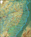
File:Pfaelzerwaldkarte Flussgebiete.png

Size of this preview: 510 × 600 pixels. Other resolutions: 204 × 240 pixels | 408 × 480 pixels | 653 × 768 pixels | 870 × 1,024 pixels | 1,741 × 2,048 pixels | 2,905 × 3,417 pixels.
Original file (2,905 × 3,417 pixels, file size: 14.74 MB, MIME type: image/png)
File history
Click on a date/time to view the file as it appeared at that time.
| Date/Time | Thumbnail | Dimensions | User | Comment | |
|---|---|---|---|---|---|
| current | 19:20, 18 January 2012 |  | 2,905 × 3,417 (14.74 MB) | Elop | k |
| 19:54, 17 January 2012 |  | 2,905 × 3,417 (14.74 MB) | Elop | update | |
| 16:01, 10 January 2012 |  | 2,905 × 3,417 (14.7 MB) | Elop | completely new | |
| 01:20, 19 December 2011 |  | 1,382 × 1,137 (2.42 MB) | Elop | Update | |
| 21:17, 16 December 2011 |  | 1,382 × 1,137 (2.42 MB) | Elop | Update | |
| 02:27, 12 December 2011 |  | 1,382 × 1,137 (2.37 MB) | Elop | insbesondere Ortsstruktur | |
| 19:16, 10 December 2011 |  | 1,382 × 1,137 (2.34 MB) | Elop | v.a. Hervorhebung | |
| 18:29, 8 December 2011 |  | 1,382 × 1,137 (2.32 MB) | Elop | update | |
| 01:02, 5 December 2011 |  | 1,382 × 1,137 (2.29 MB) | Elop | zweiter Versuch (gerade hatte sich nix geändert) | |
| 00:54, 5 December 2011 |  | 1,343 × 1,130 (2.22 MB) | Elop | Nach Westen erweitert (bis Blies) |
File usage
The following pages on the English Wikipedia use this file (pages on other projects are not listed):
Global file usage
The following other wikis use this file:
- Usage on de.wikipedia.org
- Usage on nl.wikipedia.org


